[ 3] Name on the Register[ 4]
Image
Date listed[ 5]
Location
City or town
Description
1
Almshouse Farm at Machipongo Almshouse Farm at Machipongo April 1, 2002 (#02000317 ) 12402 U.S. Route 13 37°24′16″N 75°54′18″W / 37.404444°N 75.905000°W / 37.404444; -75.905000 (Almshouse Farm at Machipongo ) Machipongo
2
Arlington Archeological Site Arlington Archeological Site May 12, 2008 (#08000422 ) Address Restricted Capeville
3
Benjamin's Department Store Benjamin's Department Store May 10, 2006 (#06000367 ) 3327 Main St. 37°31′49″N 75°49′20″W / 37.530278°N 75.822222°W / 37.530278; -75.822222 (Benjamin's Department Store ) Exmore
4
James Brown's Dry Goods Store James Brown's Dry Goods Store April 1, 2002 (#02000321 ) 16464 Courthouse Rd. 37°21′07″N 75°56′48″W / 37.351944°N 75.946667°W / 37.351944; -75.946667 (James Brown's Dry Goods Store ) Eastville
5
Brownsville Brownsville February 26, 1970 (#70000819 ) East of the junction of Seaside and Brownsville Rds. 37°28′24″N 75°49′24″W / 37.473333°N 75.823333°W / 37.473333; -75.823333 (Brownsville ) Nassawadox
6
Cape Charles Historic District Cape Charles Historic District January 3, 1991 (#90002122 ) Roughly bounded by Washington, Bay, and Mason Aves., and Fig St. 37°16′11″N 76°00′59″W / 37.269722°N 76.016389°W / 37.269722; -76.016389 (Cape Charles Historic District ) Cape Charles
7
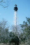
Cape Charles Light Station Cape Charles Light Station June 23, 2003 (#03000569 ) Smith Island 37°07′22″N 75°54′24″W / 37.122778°N 75.906667°W / 37.122778; -75.906667 (Cape Charles Light Station ) Kiptopeke
8
Cape Charles Rosenwald School Upload image October 26, 2023 (#100009536 ) 1500 Old Cape Charles Road 37°15′48″N 76°00′33″W / 37.2633°N 76.0092°W / 37.2633; -76.0092 (Cape Charles Rosenwald School ) Cape Charles
9
Cessford Cessford January 16, 2004 (#03001441 ) 16546 Courthouse Rd. 37°20′59″N 75°56′53″W / 37.349861°N 75.948056°W / 37.349861; -75.948056 (Cessford ) Eastville
10
John W. Chandler House John W. Chandler House November 27, 2004 (#04001270 ) 3342 Main St. 37°31′48″N 75°49′24″W / 37.530000°N 75.823333°W / 37.530000; -75.823333 (John W. Chandler House ) Exmore
11
Chatham Upload image September 20, 2022 (#100008186 ) 9218 Chatham Rd. 37°27′22″N 75°55′38″W / 37.4562°N 75.9273°W / 37.4562; -75.9273 (Chatham ) Machipongo vicinity
12
Custis Tombs Custis Tombs April 17, 1970 (#70000815 ) Arlington Chase Rd. 37°13′45″N 76°00′13″W / 37.229028°N 76.003750°W / 37.229028; -76.003750 (Custis Tombs ) Cheapside
13
Eastville Historic District Eastville Historic District October 1, 2009 (#09000795 ) Area includes U.S. Route 13 , Old Town Neck Dr., Courthouse Rd., Willow Oak Rd., Rockefellow La., and Stumptown Dr. 37°21′10″N 75°56′44″W / 37.352778°N 75.945556°W / 37.352778; -75.945556 (Eastville Historic District ) Eastville
14
Eastville Mercantile Eastville Mercantile January 20, 2005 (#04001540 ) 16429 Courthouse Rd. 37°21′10″N 75°56′46″W / 37.352694°N 75.946111°W / 37.352694; -75.946111 (Eastville Mercantile ) Eastville
15
Eyre Hall Eyre Hall November 12, 1969 (#69000265 ) West of U.S. Route 13 37°18′48″N 75°58′54″W / 37.313333°N 75.981667°W / 37.313333; -75.981667 (Eyre Hall ) Cheriton
16
Eyreville Upload image March 15, 2024 (#69000265 ) 3259 Eyreville Drive 37°19′17″N 75°58′55″W / 37.3213°N 75.9820°W / 37.3213; -75.9820 (Eyreville ) Cheriton vicinity
17
Glebe of Hungar's Parish Glebe of Hungar's Parish February 26, 1970 (#70000817 ) Northwest of the junction of Glebe and Church Neck Rds. 37°27′38″N 75°57′34″W / 37.460556°N 75.959444°W / 37.460556; -75.959444 (Glebe of Hungar's Parish ) Franktown
18
Grapeland Grapeland May 6, 1980 (#80004207 ) Grapeland Circle, north of Wardtown[ 6] 37°32′40″N 75°52′54″W / 37.544444°N 75.881667°W / 37.544444; -75.881667 (Grapeland ) Wardtown
19
Hungars Church Hungars Church October 15, 1970 (#70000813 ) East of the junction of Bayside and Church Neck Rds. 37°26′47″N 75°55′26″W / 37.446250°N 75.923889°W / 37.446250; -75.923889 (Hungars Church ) Bridgetown
20
Kendall Grove Kendall Grove June 21, 1982 (#82004576 ) Kendall Grove Rd. 37°22′56″N 75°56′34″W / 37.382222°N 75.942778°W / 37.382222; -75.942778 (Kendall Grove ) Eastville
21
Northampton County Courthouse Historic District Northampton County Courthouse Historic District April 13, 1972 (#72001410 ) East along U.S. Route 13 and extending 0.1 miles (0.16 km) to the west, north, and south from its intersection with Willow Oak Rd. 37°21′12″N 75°56′48″W / 37.353333°N 75.946667°W / 37.353333; -75.946667 (Northampton County Courthouse Historic District ) Eastville
22
Northampton Lumber Company Historic District Northampton Lumber Company Historic District May 29, 2008 (#08000480 ) Junction of U.S. Route 13 and Mill St. 37°28′24″N 75°51′30″W / 37.473333°N 75.858333°W / 37.473333; -75.858333 (Northampton Lumber Company Historic District ) Nassawadox
23
Oak Grove Upload image February 4, 1993 (#93000006 ) Northern side of Old Town Neck Dr., 1 mile (1.6 km) west of the junction with US 13 37°23′16″N 75°57′23″W / 37.387778°N 75.956389°W / 37.387778; -75.956389 (Oak Grove ) Eastville
24
Pear Valley Pear Valley November 12, 1969 (#69000266 ) South of the junction of Wilsonia Neck and Pear Cottage Drs. 37°23′48″N 75°55′22″W / 37.396667°N 75.922778°W / 37.396667; -75.922778 (Pear Valley ) Eastville
25
Selma Selma May 10, 2006 (#06000368 ) 16237 Courthouse Rd. 37°21′25″N 75°56′32″W / 37.357083°N 75.942222°W / 37.357083; -75.942222 (Selma ) Eastville
26
Stratton Manor Stratton Manor November 28, 1980 (#80004206 ) Southeast of Cape Charles off Parsons Circle 37°15′42″N 75°59′00″W / 37.261528°N 75.983333°W / 37.261528; -75.983333 (Stratton Manor ) Cape Charles
27
Upper Ridge Site Upload image August 23, 2005 (#05000914 ) Atlantic Ocean beach[ 7] 37°13′19″N 75°53′04″W / 37.221944°N 75.884444°W / 37.221944; -75.884444 (Upper Ridge Site ) Mockhorn Island
28
Vaucluse Vaucluse September 15, 1970 (#70000814 ) South of the junction of Church Neck and Sparrow Pt. Rds. 37°25′05″N 75°58′23″W / 37.418056°N 75.973056°W / 37.418056; -75.973056 (Vaucluse ) Bridgetown
29
Westerhouse House Upload image November 19, 1974 (#74002139 ) West of Bridgetown off Church Neck Rd. 37°26′52″N 75°58′06″W / 37.447639°N 75.968472°W / 37.447639; -75.968472 (Westerhouse House ) Bridgetown
30
Winona Winona October 1, 1969 (#69000264 ) Southwest of the junction of Glebe and Church Neck Rds. 37°26′25″N 75°56′08″W / 37.440139°N 75.935556°W / 37.440139; -75.935556 (Winona ) Bridgetown


