Mohyliv-Podilskyi
Mohyliv-Podilskyi
Могилів-Подільський | |
|---|---|
| |
| Coordinates: 48°27′0″N 27°47′0″E / 48.45000°N 27.78333°E | |
| Country | |
| Oblast | Vinnytsia Oblast |
| Raion | Mohyliv-Podilskyi Raion |
| Hromada | Mohyliv-Podilskyi urban hromada |
| Founded | 1595 |
| Magdeburg rights | 1743 |
| City status | 1796 |
| Government | |
| • Mayor | Petro Brovko |
| Area | |
| • Total | 21.63 km2 (8.35 sq mi) |
| Elevation | 79 m (259 ft) |
| Population (2022)[1] | |
| • Total | 29,925 |
| • Density | 1,400/km2 (3,600/sq mi) |
| Time zone | UTC+2 (EET) |
| • Summer (DST) | UTC+3 (EEST) |
| Postal code | 24000-24004 |
| Area code | +380-4337 |
| Website | mpmr |
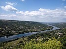
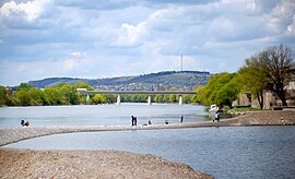
Mohyliv-Podilskyi (Ukrainian: Могилів-Подільський, IPA: [moɦɪˈliu̯ poˈdilʲsʲkɪj]) is a city in Vinnytsia Oblast, Ukraine. It serves as the administrative center of Mohyliv-Podilskyi Raion within the oblast. It is located in the historic region of Podolia, on the border with Bessarabia, Moldova, along the left bank of the Dniester River. On the opposite side of the river lies the Moldovan town of Otaci, and the two municipalities are connected to each other by a bridge. Population: 29,925 (2022 estimate).[1]
Name
[edit]In addition to the Ukrainian Могилів-Подільський (Mohyliv-Podilskyi), in other languages the name of the city is Polish: Mohylów Podolski, Romanian: Moghilău/Movilău and Yiddish: מאָהילעװ, romanized: Mohilev.
History
[edit]
Polish–Lithuanian Commonwealth 1595–1672
Ottoman Empire 1672–1699
Polish–Lithuanian Commonwealth 1699–1793
Russian Empire 1793–1917
Ukraine Ukrainian People's Republic and Ukrainian State 1917-1920
Soviet Ukraine 1920–1922
Soviet Union 1922–1941
Kingdom of Romania 1941–1944
Soviet Union 1944–1991
Ukraine 1991–present
Polish period
[edit]The first mention of the town dates from 1595. The owner of the town, Moldavian hospodar Ieremia Movilă (from which the name Mohyliv, Moghilău/Movilău in Romanian) bestowed it as a dowry gift to his daughter, who married into the Potocki family of Polish nobility. At that time, the groom named the town Movilău in honor of his father-in-law. In the first quarter of the 17th century, Mohyliv became one of the largest towns in Podolia. It was part of the Podolian Voivodeship of the Lesser Poland Province of the Polish Crown. It was a multi-ethnic border town whose population included Poles, Greeks, Armenians, Serbs, Vlachs and Bosniaks.[2] In the 18th century the main churches of the town were built: the Polish-Armenian Church of the Visitation of the Blessed Virgin Mary and the Greek St. Nicholas Church.[3] Polish rule was interrupted by Ottoman rule as part of Podolia Eyalet. During Ottoman rule, it was nahiya centre of Kamaniçe sanjak as Mıhaylov.[4]
Russian period
[edit]
The town was annexed by Russia after the 1793 Second Partition of Poland. After the restoration of Polish independence, Mohyliv was briefly captured by the Poles under the command of General Franciszek Krajowski in 1919, but it ultimately fell to the Soviet Union. In 1937, during the Polish Operation of the NKVD, the Soviets destroyed the Polish Church of the Visitation of the Blessed Virgin Mary.[citation needed]
Romanian period
[edit]Mohyliv-Podilskyi was occupied by Romanian and German troops in July 1941 and incorporated into the Romanian-ruled Transnistria Governorate. Soon thereafter, thousands of Jews in the town were murdered by the occupiers. Mohyliv-Podilskyi soon became a transit camp for Jews expelled from Bessarabia and Bukovina to Transnistria. From September 1941 to February 1942 more than 55,000 deportees came through the town. Thousands of people were jammed into the transit camp and treated cruelly by the Romanian guards.[citation needed] Many Jews were not allowed to stay in Mohyliv-Podilskyi; thousands were forced to travel by foot to nearby villages and towns. Some convoys were sent to the Pechora concentration camp. The 15,000 who were initially permitted to stay in the town organized themselves into groups. Some 2,000—3,000 were given residence permits, while the rest lived in constant fear of being deported into the Transnistrian interior for forced labor.
In December 1943 over 3,000 Jews were allowed to return to Romania, and in March 1944, Jewish leaders in Bucharest got permission to bring back 1,400 orphans. Mohyliv-Podilskyi was liberated that month; many Jewish men were immediately drafted by the Soviet army. Many who stayed in the city were killed by German bombs. Most of the deportees were allowed to return to Romania in the spring of 1945.[citation needed]
Ukrainian period
[edit]Mohyliv-Podilskyi has been part of Ukraine since August 24, 1991.
On November 10, 2016, in Mohyliv-Podilskyi, a memorial to the heroes of border guards who died in 1941 was opened.[5]
Population
[edit]Language
[edit]Distribution of the population by native language according to the 2001 census:[6]
| Language | Percentage |
|---|---|
| Ukrainian | 92.25% |
| Russian | 7.06% |
| other/undecided | 0.69% |
Geography
[edit]The city is located in the southwest of the Vinnytsia region in the ravine formed by the Dniester River and other ravines (Karpivskyi yar), which are formed by the rivers that enter the Dniester basin (Derlo, Nemia, etc.). During the period of snow melting and after rains, temporary drains flow along the bottoms of the beams and the slopes of the ravines.
The average height above sea level is 80 m.
Climate
[edit]| Climate data for Mohyliv-Podilskyi (1981–2010) | |||||||||||||
|---|---|---|---|---|---|---|---|---|---|---|---|---|---|
| Month | Jan | Feb | Mar | Apr | May | Jun | Jul | Aug | Sep | Oct | Nov | Dec | Year |
| Mean daily maximum °C (°F) | 1.1 (34.0) |
2.9 (37.2) |
8.7 (47.7) |
16.4 (61.5) |
23.0 (73.4) |
25.8 (78.4) |
27.8 (82.0) |
27.4 (81.3) |
21.8 (71.2) |
15.5 (59.9) |
7.4 (45.3) |
2.1 (35.8) |
15.0 (59.0) |
| Daily mean °C (°F) | −2.3 (27.9) |
−1.2 (29.8) |
3.4 (38.1) |
10.0 (50.0) |
16.0 (60.8) |
19.0 (66.2) |
20.9 (69.6) |
20.0 (68.0) |
14.9 (58.8) |
9.3 (48.7) |
3.6 (38.5) |
−1.0 (30.2) |
9.4 (48.9) |
| Mean daily minimum °C (°F) | −5.6 (21.9) |
−4.8 (23.4) |
−1.0 (30.2) |
4.4 (39.9) |
9.2 (48.6) |
12.7 (54.9) |
14.6 (58.3) |
13.6 (56.5) |
9.3 (48.7) |
4.6 (40.3) |
0.4 (32.7) |
−3.9 (25.0) |
4.5 (40.1) |
| Average precipitation mm (inches) | 29.0 (1.14) |
28.1 (1.11) |
27.7 (1.09) |
45.3 (1.78) |
64.2 (2.53) |
86.7 (3.41) |
97.1 (3.82) |
57.4 (2.26) |
55.4 (2.18) |
33.5 (1.32) |
39.3 (1.55) |
32.7 (1.29) |
596.4 (23.48) |
| Average precipitation days (≥ 1.0 mm) | 6.1 | 6.6 | 6.0 | 7.7 | 8.6 | 9.0 | 9.3 | 7.0 | 6.4 | 5.7 | 6.4 | 7.1 | 85.9 |
| Average relative humidity (%) | 80.4 | 77.8 | 71.6 | 66.4 | 66.8 | 71.3 | 72.2 | 72.3 | 75.4 | 78.1 | 81.4 | 82.2 | 74.7 |
| Source: NOAA[7] | |||||||||||||
Economy
[edit]Now working in the city:
- Mohyliv-Podilsky Machine-Building Plant;
- metalworking plants;
- light and food industry enterprises, etc.
Notable people
[edit]- Boris Bazhanov (1900–1982), Stalin's personal secretary who later defected
- Witold Maliszewski (1873–1939), a Polish composer, professor of the Warsaw Conservatory, was born in Mohyliv-Podilskyi.
- Chaim Towber (1901–1972), American actor, best known as the author of the song I Love You Much Too Much
- Samuel Yellin (1884–1940), American master blacksmith and metal designer, born in Mohyliv-Podilskyi
- Adella Kean Zametkin (1863–1931), American socialist and writer, was born in Mohyliv-Podilskyi
- Leonid Mosendz - Ukrainian poet
- Ivan Hlyinskyi - Ukrainian poet
- Serhii Naiev - Ukrainian lieutenant general who served as Commander of the Joint Forces of the Armed Forces of Ukraine from 2016 until 2024.
- Hennadii Vatsak (born 1972), Ukrainian businessman and politician
Gallery
[edit]-
19th century architecture in Mohyliv-Podilskyj
-
City centre
-
St. Nicholas Church
-
St. George Church
-
Saint Alexander Nevsky Church
-
Nikolai Gogol monument
-
John Lennon monument
International relations
[edit]Twin towns — sister cities
[edit]Mohyliv-Podilskyi is twinned with:
 Bakhmut, Ukraine
 Koziatyn, Ukraine
 Końskie, Poland
 Połaniec, Poland
 Środa Wielkopolska, Poland
 Bălți, Moldova
 Pitești, Romania
 Šaľa, Slovakia
 Cavriglia, Italy
References
[edit]- ^ a b Чисельність наявного населення України на 1 січня 2022 [Number of Present Population of Ukraine, as of January 1, 2022] (PDF) (in Ukrainian and English). Kyiv: State Statistics Service of Ukraine. Archived (PDF) from the original on 4 July 2022.
- ^ Geographical Dictionary of the Kingdom of Poland, vol. 6, p. 613-614
- ^ Geographical Dictionary of the Kingdom of Poland, vol. 6, p. 614
- ^ "The Eyalet of Kamanice". Archived from the original on 2016-04-09. Retrieved 2020-11-25.
- ^ "У Могилеві-Подільському відкрили Меморіал пам'яті загиблим героям-прикордонникам". Archived from the original on 2018-08-29.
- ^ "Рідні мови в об'єднаних територіальних громадах України".
- ^ "World Meteorological Organization Climate Normals for 1981–2010". National Centers for Environmental Information. Archived from the original on 17 July 2021. Retrieved 17 July 2021.


