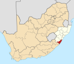
Mayfield, South Africa
Appearance
(Redirected from Mayfield, KwaZulu–Natal)
This article needs additional citations for verification. (January 2014) |
Mayfield | |
|---|---|
| Coordinates: 30°15′40″S 30°30′18″E / 30.261°S 30.505°E | |
| Country | South Africa |
| Province | KwaZulu-Natal |
| District | Ugu |
| Municipality | Umdoni |
| Area | |
• Total | 0.88 km2 (0.34 sq mi) |
| Population (2011)[1] | |
• Total | 1,003 |
| • Density | 1,100/km2 (3,000/sq mi) |
| Racial makeup (2011) | |
| • Black African | 99.3% |
| • Indian/Asian | 0.2% |
| • Other | 0.5% |
| First languages (2011) | |
| • Zulu | 95.2% |
| • S. Ndebele | 2.0% |
| • English | 1.1% |
| • Other | 1.7% |
| Time zone | UTC+2 (SAST) |
Mayfield is an area south of Braemar in Umzinto, South Africa, surrounded by Mbungulu, Braemar, and Mkhunya/Dumisa. It is located under Ugu District Municipality at an offramp, D307 in Sawoti, opposite Sawoti Police Station, that road goes to Mbungulu and Ncazuka.
In this area is where you will find Himmelberg Intermediate School, Mayfield and the road, D307 will also take you to Phungula Primary School, kwaMbungulu.
References
[edit]- ^ a b c d "Main Place Mayfield". Census 2011.


