Shuniah
Shuniah | |
|---|---|
| Municipality of Shuniah | |
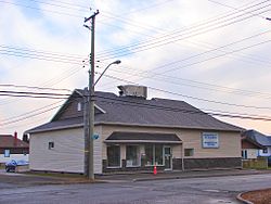
 Township hall | |
| Coordinates: 48°35′N 88°50′W / 48.583°N 88.833°W | |
| Country | Canada |
| Province | Ontario |
| District | Thunder Bay |
| Settled | 1860s |
| Incorporated (Township) | 1873 |
| Incorporated (Municipality) | 2011 |
| Government | |
| • Mayor | Wendy Landry |
| • Federal riding | Thunder Bay—Superior North |
| • Prov. riding | Thunder Bay—Superior North |
| Area | |
| • Land | 570.99 km2 (220.46 sq mi) |
| Population (2011)[2] | |
• Total | 2,798 |
| • Density | 4.9/km2 (13/sq mi) |
| Time zone | UTC-5 (EST) |
| • Summer (DST) | UTC-4 (EDT) |
| Postal Code FSA | P0T & P7A |
| Area code | 807 |
| Website | www.shuniah.org |
Shuniah (/ˈʃuːniə/) is a municipal township bordering the city of Thunder Bay, Ontario, Canada on the east. Shuniah was incorporated by an act of the Ontario legislature in 1873, and at that time included much of present-day Thunder Bay and its predecessor and surrounding municipalities.[3] It gradually shrunk in size until by 1936 it included only three wards, the geographic townships of McIntyre, McGregor, and McTavish. That year it had the Ontario Legislative Assembly remove a number of islands in Lake Superior that had formed the Island Ward since 1873.[4] In 1970 McIntyre Township was amalgamated into the city of Thunder Bay. Shuniah, named after the Ojibwa word "zhooniyaa" for "money" or "silver" (see the French argent), was settled largely due to silver mining potential identified in the mid-19th century.
The township is part of Thunder Bay's Census Metropolitan Area, and consists of the communities of Amethyst Harbour, Ancliff, Bowker, Ishkibibble, Loon, Mackenzie, Navilus, Pass Lake, Pearl, Silver Harbour and Wild Goose.
Serving today primarily as a rural bedroom community to Thunder Bay, Shuniah is also a popular cottaging locale with 40 kilometres of Lake Superior's northern shoreline. The township was home to the Lake Superior Trout Hunt during the 1970s and 1980s.
From 1994 to 2014, the township reeve was Maria Harding. On October 27, 2014, Wendy Landry was elected as Reeve and as of January 26, 2015 the title of the Head of Council was changed from Reeve to Mayor. Landry was re-elected in 2018.[5]
Demographics
[edit]In the 2021 Census of Population conducted by Statistics Canada, Shuniah had a population of 3,247 living in 1,425 of its 2,088 total private dwellings, a change of 16% from its 2016 population of 2,798. With a land area of 571.34 km2 (220.60 sq mi), it had a population density of 5.7/km2 (14.7/sq mi) in 2021.[6]
| 2016 | 2011 | |
|---|---|---|
| Population | 2,798 (+2.2% from 2011) | 2,737 (-6.0% from 2006) |
| Land area | 570.99 km2 (220.46 sq mi) | 570.98 km2 (220.46 sq mi) |
| Population density | 4.9/km2 (13/sq mi) | 4.8/km2 (12/sq mi) |
| Median age | 52.8 (M: 53.6, F: 51.9) | 51.7 (M: 52.6, F: 50.7) |
| Private dwellings | 2,130 (total) | 2,156 (total) |
| Median household income | $96,939 |
| Year | Pop. | ±% |
|---|---|---|
| 1991 | 2,182 | — |
| 1996 | 2,346 | +7.5% |
| 2001 | 2,466 | +5.1% |
| 2006 | 2,913 | +18.1% |
| 2011 | 2,737 | −6.0% |
| 2016 | 2,798 | +2.2% |
| [11][1][2] | ||

See also
[edit]References
[edit]- ^ a b "Shuniah, Ontario (Code 3558028) census profile". 2011 Census of Population. Statistics Canada. Retrieved 2012-03-29.
- ^ a b "Census Profile, 2016 Census: Shuniah". Statistics Canada. 8 February 2017. Retrieved July 11, 2019.
- ^ "Municipality of Shuniah electoral history 1873-1884," F.B. Scollie, Thunder Bay Mayors & Councillors, 1873-1945 (Thunder Bay Historical Museum Society, 2000), pages 12-15, with map.
- ^ Port Arthur News-Chronicle, 4 Jan 1936, 13.
- ^ "Election 2018". Municipality of Shuniah. Retrieved July 11, 2019.
- ^ "Population and dwelling counts: Canada, provinces and territories, census divisions and census subdivisions (municipalities), Ontario". Statistics Canada. February 9, 2022. Retrieved March 31, 2022.
- ^ "2016 Community Profiles". 2016 Canadian census. Statistics Canada. August 12, 2021. Retrieved 2019-07-11.
- ^ "2011 Community Profiles". 2011 Canadian census. Statistics Canada. March 21, 2019. Retrieved 2012-03-29.
- ^ "2006 Community Profiles". 2006 Canadian census. Statistics Canada. August 20, 2019.
- ^ "2001 Community Profiles". 2001 Canadian census. Statistics Canada. July 18, 2021.
- ^ Statistics Canada: 1996, 2001, 2006 census


