Loris, South Carolina
Loris, South Carolina | |
|---|---|
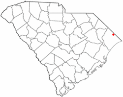
 Location of Loris in South Carolina | |
| Coordinates: 34°3′32″N 78°53′28″W / 34.05889°N 78.89111°W | |
| Country | United States |
| State | South Carolina |
| County | Horry |
| Incorporated (town) | 1938 |
| Incorporated (city) | 1957 |
| Government | |
| • Mayor | Michael E. Suggs |
| Area | |
• Total | 4.57 sq mi (11.84 km2) |
| • Land | 4.55 sq mi (11.79 km2) |
| • Water | 0.02 sq mi (0.05 km2) |
| Elevation | 98 ft (30 m) |
| Population | |
• Total | 2,449 |
| • Density | 537.89/sq mi (207.70/km2) |
| Time zone | UTC-5 (EST) |
| • Summer (DST) | UTC-4 (EDT) |
| ZIP code | 29569 |
| Area code(s) | 843, 854 |
| FIPS code | 45-42730[3] |
| GNIS feature ID | 1246470[4] |
| Website | www |
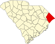
Loris is a city in Horry County, South Carolina, United States. The population was 2,396 at the 2010 census,[5] up from 2,079 in 2000.
History
[edit]Loris was founded on December 7, 1887 as a railroad town, originally serving the Wilmington, Chadbourn, and Conway Railroad.[6] Loris was later incorporated on July 26, 1902.[6] The first brick building, which housed the Bank of Loris, opened in 1907.[6] Telephone lines to Conway were first used in 1909.[6] The town grew steadily in the 1920's and 1930's; a high school opened in 1920, and by the 1930's, Loris had around 1,000 residents.[6] In the 1970's, Loris legally became a city.[6]
Geography
[edit]Loris is in northern Horry County on the Atlantic coastal plain.
Highways include U.S. Route 701, and SC Highway 9 Business (Main Street).
According to the United States Census Bureau, the city of Loris has a total area of 4.6 square miles (11.8 km2), of which 0.02 square miles (0.05 km2), or 0.43%, are water.[5]
Demographics
[edit]| Census | Pop. | Note | %± |
|---|---|---|---|
| 1910 | 229 | — | |
| 1920 | 666 | 190.8% | |
| 1930 | 900 | 35.1% | |
| 1940 | 1,238 | 37.6% | |
| 1950 | 1,614 | 30.4% | |
| 1960 | 1,702 | 5.5% | |
| 1970 | 1,741 | 2.3% | |
| 1980 | 2,193 | 26.0% | |
| 1990 | 2,067 | −5.7% | |
| 2000 | 2,079 | 0.6% | |
| 2010 | 2,396 | 15.2% | |
| 2020 | 2,449 | 2.2% | |
| U.S. Decennial Census[7][2] | |||
2020 census
[edit]| Race | Num. | Perc. |
|---|---|---|
| White (non-Hispanic) | 1,295 | 52.88% |
| Black or African American (non-Hispanic) | 918 | 37.48% |
| Native American | 7 | 0.29% |
| Asian | 30 | 1.22% |
| Pacific Islander | 3 | 0.12% |
| Other/Mixed | 84 | 3.43% |
| Hispanic or Latino | 112 | 4.57% |
As of the 2020 United States census, there were 2,449 people, 1,152 households, and 656 families residing in the city.
2010 census
[edit]As of the census[3] of 2010, there were 2,396 people, 819 households, and 546 families residing in the city which indicated a +15.2 growth. The population density was 668.2 inhabitants per square mile (258.0/km2). There were 922 housing units at an average density of 296.3 per square mile (114.4/km2). The racial makeup of the city was 52.8% White, 39.4% African American, 0.08% Native American, 1.2% Asian, 0.03% from other races, and 1.5% from two or more races. Hispanic or Latino of any race were 4.4% of the population.
There were 967 households, out of which 25.4% had children under the age of 18 living with them, 42.7% were married couples living together, 21.1% had a female householder with no husband present, and 33.3% were non-families. 29.3% of all households were made up of individuals, and 12.6% had someone living alone who was 65 years of age or older. The average household size was 2.43 and the average family size was 3.01.
In the city, the population was spread out, with 22.5% under the age of 18, 9.7% from 18 to 24, 24.7% from 25 to 44, 24.4% from 45 to 64, and 18.8% who were 65 years of age or older. The median age was 40 years. For every 100 females, there were 82.4 males. For every 100 females age 18 and over, there were 74.5 males.
The median income for a household in the city was $26,250, and the median income for a family was $33,036. Males had a median income of $25,750 versus $17,180 for females. The per capita income for the city was $13,779. About 22.7% of families and 28.8% of the population were below the poverty line, including 44.7% of those under age 18 and 20.7% of those age 65 or over.
Arts and culture
[edit]The annual Loris Bog-off is held on the third weekend in October, in the downtown Loris area. Chicken bog[9] is a dish of chicken, rice, sausage and spices; it originated in the Pee Dee area of South Carolina. The Loris Bog-off features carnival-type rides, concessions, regional performers, and petting zoo animals. Local schools also participate in performances and many other contests such as duck calling are held.
Loris has a public library, a branch of the Horry County Memorial Library.[10]
Media
[edit]- The Loris Times (local news)
- Tabor-Loris Tribune (local news)[11]
Radio
[edit]Infrastructure
[edit]Twin City Airport is a local airport for light aircraft.[12] The Coast RTA bus system serves Loris.[13]
Notable people
[edit]- Robert H. Brooks, founder of Hooters in the mid-1980s and the Naturally Fresh Foods in Atlanta in 1966.
References
[edit]- ^ "ArcGIS REST Services Directory". United States Census Bureau. Retrieved October 15, 2022.
- ^ a b "Census Population API". United States Census Bureau. Retrieved October 15, 2022.
- ^ a b "U.S. Census website". United States Census Bureau. Retrieved January 31, 2008.
- ^ "US Board on Geographic Names". United States Geological Survey. October 25, 2007. Retrieved January 31, 2008.
- ^ a b "Geographic Identifiers: 2010 Census Summary File 1 (G001): Loris city, South Carolina". American Factfinder. U.S. Census Bureau. Archived from the original on February 13, 2020. Retrieved January 25, 2018.
- ^ a b c d e f "Loris Chamber of Commerce". Loris Chamber of Commerce. Retrieved October 14, 2024.
- ^ "Census of Population and Housing". Census.gov. Retrieved June 4, 2015.
- ^ "Explore Census Data". data.census.gov. Retrieved December 15, 2021.
- ^ Chicken Bog
- ^ "Locations & Hours". Greenville County Library System. Retrieved June 8, 2019.
- ^ http://www.tabor-loris.com
- ^ http://www.airnav.com/airport/5J9
- ^ The Coast RTA


