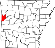
List of lakes of Sebastian County, Arkansas
Appearance
(Redirected from List of lakes in Sebastian County, Arkansas)
There are at least 25 named lakes and reservoirs in Sebastian County, Arkansas.
Lakes
[edit]- Courthouse Slough, 35°25′10″N 094°07′41″W / 35.41944°N 94.12806°W, el. 394 feet (120 m) [1]
- Greenwood Lake, 35°11′16″N 094°14′42″W / 35.18778°N 94.24500°W, el. 522 feet (159 m) [2]
- Lake Spur, 35°01′10″N 094°14′24″W / 35.01944°N 94.24000°W, el. 709 feet (216 m) [3]
- Sugar Loaf Lake, 35°05′32″N 094°24′25″W / 35.09222°N 94.40694°W, el. 643 feet (196 m) [4]
Reservoirs
[edit]- Bailey Hill Reservoir, 35°21′51″N 094°25′04″W / 35.36417°N 94.41778°W, el. 564 feet (172 m) [5]
- Booneville Lake, 35°08′52″N 094°03′36″W / 35.14778°N 94.06000°W, el. 535 feet (163 m) [6]
- Crain Lake, 35°23′00″N 094°21′49″W / 35.38333°N 94.36361°W, el. 436 feet (133 m) [7]
- Crouch Lake, 35°18′46″N 094°09′11″W / 35.31278°N 94.15306°W, el. 453 feet (138 m) [8]
- Crowe Hill Reservoir, 35°20′48″N 094°23′45″W / 35.34667°N 94.39583°W, el. 705 feet (215 m) [9]
- Echols Lake, 35°21′30″N 094°23′14″W / 35.35833°N 94.38722°W, el. 574 feet (175 m) [10]
- Engineer Lake, 35°16′47″N 094°06′58″W / 35.27972°N 94.11611°W, el. 440 feet (130 m) [11]
- Gurisco Lake, 35°15′58″N 094°26′00″W / 35.26611°N 94.43333°W, el. 466 feet (142 m) [12]
- Lake Number One, 35°01′29″N 094°16′07″W / 35.02472°N 94.26861°W, el. 656 feet (200 m) [13]
- Lake Number Two, 35°00′54″N 094°16′55″W / 35.01500°N 94.28194°W, el. 676 feet (206 m) [14]
- Mansfield Lake, 35°03′30″N 094°14′07″W / 35.05833°N 94.23528°W, el. 636 feet (194 m) [15]
- McMahan Lake, 35°19′41″N 094°18′02″W / 35.32806°N 94.30056°W, el. 446 feet (136 m) [16]
- Number Name Lake, 35°21′30″N 094°07′33″W / 35.35833°N 94.12583°W, el. 417 feet (127 m) [17]
- Park Lake, 35°00′54″N 094°15′31″W / 35.01500°N 94.25861°W, el. 732 feet (223 m) [18]
- Pool 13, 35°21′00″N 094°17′31″W / 35.35000°N 94.29194°W, el. 387 feet (118 m) [19]
- Sebastian Lake, 35°12′55″N 094°24′17″W / 35.21528°N 94.40472°W, el. 604 feet (184 m) [20]
- Shadow Lake, 35°13′57″N 094°17′59″W / 35.23250°N 94.29972°W, el. 653 feet (199 m) [21]
- Wildcat Mountain Lake, 35°22′01″N 094°20′56″W / 35.36694°N 94.34889°W, el. 436 feet (133 m) [22]
- Williamson Lake, 35°14′16″N 094°17′09″W / 35.23778°N 94.28583°W, el. 587 feet (179 m) [23]
- Willies Lake, 35°18′17″N 094°20′12″W / 35.30472°N 94.33667°W, el. 495 feet (151 m) [24]
- Wofford Lake, 35°13′20″N 094°26′03″W / 35.22222°N 94.43417°W, el. 548 feet (167 m) [25]
See also
[edit]Notes
[edit]- ^ "Courthouse Slough". Geographic Names Information System. United States Geological Survey, United States Department of the Interior.
- ^ "Greenwood Lake". Geographic Names Information System. United States Geological Survey, United States Department of the Interior.
- ^ "Lake Spur". Geographic Names Information System. United States Geological Survey, United States Department of the Interior.
- ^ "Sugar Loaf Lake". Geographic Names Information System. United States Geological Survey, United States Department of the Interior.
- ^ "Bailey Hill Reservoir". Geographic Names Information System. United States Geological Survey, United States Department of the Interior.
- ^ "Booneville Lake". Geographic Names Information System. United States Geological Survey, United States Department of the Interior.
- ^ "Crain Lake". Geographic Names Information System. United States Geological Survey, United States Department of the Interior.
- ^ "Crouch Lake". Geographic Names Information System. United States Geological Survey, United States Department of the Interior.
- ^ "Crowe Hill Reservoir". Geographic Names Information System. United States Geological Survey, United States Department of the Interior.
- ^ "Echols Lake". Geographic Names Information System. United States Geological Survey, United States Department of the Interior.
- ^ "Engineer Lake". Geographic Names Information System. United States Geological Survey, United States Department of the Interior.
- ^ "Gurisco Lake". Geographic Names Information System. United States Geological Survey, United States Department of the Interior.
- ^ "Lake Number One". Geographic Names Information System. United States Geological Survey, United States Department of the Interior.
- ^ "Lake Number Two". Geographic Names Information System. United States Geological Survey, United States Department of the Interior.
- ^ "Mansfield Lake". Geographic Names Information System. United States Geological Survey, United States Department of the Interior.
- ^ "McMahan Lake". Geographic Names Information System. United States Geological Survey, United States Department of the Interior.
- ^ "Number Name Lake". Geographic Names Information System. United States Geological Survey, United States Department of the Interior.
- ^ "Park Lake". Geographic Names Information System. United States Geological Survey, United States Department of the Interior.
- ^ "Pool 13". Geographic Names Information System. United States Geological Survey, United States Department of the Interior.
- ^ "Sebastian Lake". Geographic Names Information System. United States Geological Survey, United States Department of the Interior.
- ^ "Shadow Lake". Geographic Names Information System. United States Geological Survey, United States Department of the Interior.
- ^ "Wildcat Mountain Lake". Geographic Names Information System. United States Geological Survey, United States Department of the Interior.
- ^ "Williamson Lake". Geographic Names Information System. United States Geological Survey, United States Department of the Interior.
- ^ "Willies Lake". Geographic Names Information System. United States Geological Survey, United States Department of the Interior.
- ^ "Wofford Lake". Geographic Names Information System. United States Geological Survey, United States Department of the Interior.

