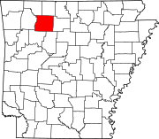
List of lakes of Perry County, Arkansas
Appearance
(Redirected from List of lakes in Perry County, Arkansas)
There are at least 28 named lakes and reservoirs in Perry County, Arkansas.
Lakes
[edit]- Bull Lake, 34°57′47″N 092°51′55″W / 34.96306°N 92.86528°W, el. 279 feet (85 m) [1]
- Bull Lake Slough, 34°58′33″N 092°50′55″W / 34.97583°N 92.84861°W, el. 272 feet (83 m) [2]
- Clear Lake, 34°58′14″N 092°50′36″W / 34.97056°N 92.84333°W, el. 269 feet (82 m) [3]
- Open Lake, 34°58′24″N 092°42′58″W / 34.97333°N 92.71611°W, el. 276 feet (84 m) [4]
- Winford Brake, 34°59′36″N 092°41′05″W / 34.99333°N 92.68472°W, el. 259 feet (79 m) [5]
Reservoirs
[edit]- Big Fish Pond, 34°58′06″N 092°57′31″W / 34.96833°N 92.95861°W, el. 318 feet (97 m) [6]
- Clear Water Lake, 35°02′28″N 092°57′54″W / 35.04111°N 92.96500°W, el. 486 feet (148 m) [7]
- Cove Creek Lake, 34°54′55″N 093°04′10″W / 34.91528°N 93.06944°W, el. 384 feet (117 m) [8]
- Darby's Pond, 34°58′35″N 092°49′04″W / 34.97639°N 92.81778°W, el. 289 feet (88 m) [9]
- Deltic Farms Lake, 34°53′23″N 092°46′17″W / 34.88972°N 92.77139°W, el. 449 feet (137 m) [10]
- Francis Lake, 34°58′37″N 092°39′02″W / 34.97694°N 92.65056°W, el. 266 feet (81 m) [11]
- Harris Brake, 34°58′35″N 092°46′16″W / 34.97639°N 92.77111°W, el. 282 feet (86 m) [12]
- Harris Brake Public Fishing Lake, 34°59′12″N 092°46′31″W / 34.98667°N 92.77528°W, el. 279 feet (85 m) [13]
- Henry Lake, 34°55′21″N 092°48′22″W / 34.92250°N 92.80611°W, el. 669 feet (204 m) [14]
- Jones Lake Number Two, 35°05′22″N 092°33′38″W / 35.08944°N 92.56056°W, el. 285 feet (87 m) [15]
- Lake Sylvia, 34°52′09″N 092°49′20″W / 34.86917°N 92.82222°W, el. 633 feet (193 m) [16]
- Ouachita Creek Watershed Site One Reservoir, 35°02′28″N 092°34′19″W / 35.04111°N 92.57194°W, el. 285 feet (87 m) [17]
- Ouachita Creek Watershed Site Three Reservoir, 35°04′06″N 092°34′03″W / 35.06833°N 92.56750°W, el. 279 feet (85 m) [18]
- Ouachita Creek Watershed Site Two Reservoir, 35°03′06″N 092°33′55″W / 35.05167°N 92.56528°W, el. 282 feet (86 m) [19]
- Owens Lake, 35°05′42″N 093°33′37″W / 35.09500°N 93.56028°W, el. 348 feet (106 m) [20]
- Rock Creek Lake, 34°55′37″N 092°57′51″W / 34.92694°N 92.96417°W, el. 387 feet (118 m) [21]
- South Fouche Site Seven Reservoir, 35°00′46″N 092°49′32″W / 35.01278°N 92.82556°W, el. 410 feet (120 m) [22]
- South Fouche Site Six Reservoir, 34°55′37″N 092°57′51″W / 34.92694°N 92.96417°W, el. 387 feet (118 m) [23]
- South Fourche Site One Reservoir, 34°51′54″N 093°11′27″W / 34.86500°N 93.19083°W, el. 577 feet (176 m) [24]
- The Campbells Lake, 34°56′36″N 092°34′19″W / 34.94333°N 92.57194°W, el. 525 feet (160 m) [25]
- Van Dalsen Lake, 34°59′36″N 092°44′31″W / 34.99333°N 92.74194°W, el. 289 feet (88 m) [26]
- Willenberg Lake, 35°02′06″N 092°54′37″W / 35.03500°N 92.91028°W, el. 397 feet (121 m) [27]
- Womack Lake, 35°02′30″N 092°51′13″W / 35.04167°N 92.85361°W, el. 322 feet (98 m) [28]
See also
[edit]Notes
[edit]- ^ "Bull Lake". Geographic Names Information System. United States Geological Survey, United States Department of the Interior.
- ^ "Bull Lake Slough". Geographic Names Information System. United States Geological Survey, United States Department of the Interior.
- ^ "Clear Lake". Geographic Names Information System. United States Geological Survey, United States Department of the Interior.
- ^ "Open Lake". Geographic Names Information System. United States Geological Survey, United States Department of the Interior.
- ^ "Winford Brake". Geographic Names Information System. United States Geological Survey, United States Department of the Interior.
- ^ "Big Fish Pond". Geographic Names Information System. United States Geological Survey, United States Department of the Interior.
- ^ "Clear Water Lake". Geographic Names Information System. United States Geological Survey, United States Department of the Interior.
- ^ "Cove Creek Lake". Geographic Names Information System. United States Geological Survey, United States Department of the Interior.
- ^ "Darbys Pond". Geographic Names Information System. United States Geological Survey, United States Department of the Interior.
- ^ "Deltic Farms Lake". Geographic Names Information System. United States Geological Survey, United States Department of the Interior.
- ^ "Francis Lake". Geographic Names Information System. United States Geological Survey, United States Department of the Interior.
- ^ "Harris Brake". Geographic Names Information System. United States Geological Survey, United States Department of the Interior.
- ^ "Harris Brake Public Fishing Lake". Geographic Names Information System. United States Geological Survey, United States Department of the Interior.
- ^ "Henry Lake". Geographic Names Information System. United States Geological Survey, United States Department of the Interior.
- ^ "Jones Lake Number Two". Geographic Names Information System. United States Geological Survey, United States Department of the Interior.
- ^ "Lake Sylvia". Geographic Names Information System. United States Geological Survey, United States Department of the Interior.
- ^ "Ouachita Creek Watershed Site One Reservoir". Geographic Names Information System. United States Geological Survey, United States Department of the Interior.
- ^ "Ouachita Creek Watershed Site Three Reservoir". Geographic Names Information System. United States Geological Survey, United States Department of the Interior.
- ^ "Ouachita Creek Watershed Site Two Reservoir". Geographic Names Information System. United States Geological Survey, United States Department of the Interior.
- ^ "Owens Lake". Geographic Names Information System. United States Geological Survey, United States Department of the Interior.
- ^ "Rock Creek Lake". Geographic Names Information System. United States Geological Survey, United States Department of the Interior.
- ^ "South Fouche Site Seven Reservoir". Geographic Names Information System. United States Geological Survey, United States Department of the Interior.
- ^ "South Fouche Site Six Reservoir". Geographic Names Information System. United States Geological Survey, United States Department of the Interior.
- ^ "South Fourche Site One Reservoir". Geographic Names Information System. United States Geological Survey, United States Department of the Interior.
- ^ "The Campbells Lake". Geographic Names Information System. United States Geological Survey, United States Department of the Interior.
- ^ "Van Dalsen Lake". Geographic Names Information System. United States Geological Survey, United States Department of the Interior.
- ^ "Willenberg Lake". Geographic Names Information System. United States Geological Survey, United States Department of the Interior.
- ^ "Womack Lake". Geographic Names Information System. United States Geological Survey, United States Department of the Interior.

