Lengerich station
Appearance
(Redirected from Langerich railway station)
This article needs additional citations for verification. (March 2012) |
| Bf | |||||||||||||||||||||||
 2008 | |||||||||||||||||||||||
| General information | |||||||||||||||||||||||
| Location | Bahnhofstraße 193 49525 Lengerich North Rhine-Westphalia Germany | ||||||||||||||||||||||
| Elevation | 79 m (259 ft) | ||||||||||||||||||||||
| Owned by | Deutsche Bahn | ||||||||||||||||||||||
| Operated by | |||||||||||||||||||||||
| Line(s) | |||||||||||||||||||||||
| Platforms | 1 island platform 1 side platform | ||||||||||||||||||||||
| Tracks | 10 | ||||||||||||||||||||||
| Train operators | |||||||||||||||||||||||
| Connections | |||||||||||||||||||||||
| Construction | |||||||||||||||||||||||
| Parking | yes | ||||||||||||||||||||||
| Bicycle facilities | yes | ||||||||||||||||||||||
| Accessible | partly | ||||||||||||||||||||||
| Other information | |||||||||||||||||||||||
| Station code | 3662 | ||||||||||||||||||||||
| DS100 code | ELEN[1] | ||||||||||||||||||||||
| IBNR | 8003640 | ||||||||||||||||||||||
| Category | 5[2] | ||||||||||||||||||||||
| Fare zone |
| ||||||||||||||||||||||
| Website | www.bahnhof.de | ||||||||||||||||||||||
| Services | |||||||||||||||||||||||
| |||||||||||||||||||||||
 | |||||||||||||||||||||||
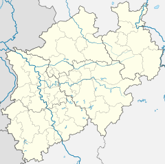
Lengerich is a railway station located in Lengerich, Germany.
History
[edit]The station is located on the Wanne-Eickel–Hamburg railway line. The train services are operated by DB Regio NRW and eurobahn.
Train services
[edit]The following services currently call at Lengerich:
| Series | Train Type | Route | Material | Frequency |
|---|---|---|---|---|
| RB 66 | eurobahn
Teuto-Bahn |
Osnabrück Hbf - Hasbergen - Natrup-Hagen - Lengerich - Kattenvenne - Ostbevern - Westbevern - Münster Hbf | 2x per hour |
References
[edit]- ^ Eisenbahnatlas Deutschland (German railway atlas) (2017 ed.). Schweers + Wall. 2017. ISBN 978-3-89494-146-8.
- ^ "Stationspreisliste 2024" [Station price list 2024] (PDF) (in German). DB Station&Service. 24 April 2023. Retrieved 29 November 2023.
- ^ "Fahrtauskunft". Westfalentarif. Retrieved 18 May 2020.
- ^ "Ticket- und Tarifbroschüre" (PDF). Verkehrsgemeinschaft Osnabrück. 27 August 2020. Retrieved 2 December 2020.
52°10′32″N 7°52′45″E / 52.17556°N 7.87917°E


