Lambaréné
You can help expand this article with text translated from the corresponding article in French. Click [show] for important translation instructions.
|
Lambaréné | |
|---|---|
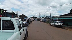
 Street in Lambaréné | |
| Coordinates: 0°41′18″S 10°13′55″E / 0.68833°S 10.23194°E | |
| Country | |
| Province | Moyen-Ogooué |
| Population (2013 census) | |
• Total | 38,775 |
Lambaréné is a town and the capital of Moyen-Ogooué in Gabon. It has a population of 38,775 as of 2013, and is located 75 kilometres south of the equator.
Lambaréné is based in the Central African Rainforest at the river Ogooué. This river divides the city into 3 districts: Rive Gauche, Ile Lambaréné and Rive Droite. The Albert Schweitzer Hospital and the districts Adouma and Abongo are located on Rive Droite. The districts Atongowanga, Sahoty, Dakar, Grand Village, Château, Lalala and Bordamur build the Ile Lambaréné. The majority of the people in Lambaréné live in the district Isaac located on Rive Gauche. This district hosts the Lambaréné Airport.
Today[when?] Lambaréné is inhabited mainly by Bantu ethnic groups such as the Fang, Bapounou, Eshira, and Myéné; these displaced the Pygmies to the east and north of Gabon. The main economic activity in the town is the fishery and a new port is under construction.
Albert Schweitzer hospital
[edit]
The Franco-German Nobel Peace Prize winner Albert Schweitzer (1875–1965) founded his hospital in Lambaréné in 1913. Today, the Hôpital Albert Schweitzer comprises departments of Internal Medicine, Surgery, Paediatrics, a maternity clinic, a dentistry clinic and since 1981 a Medical Research Unit, which focuses on malaria research.[1][2]
Climate
[edit]Lambaréné has a tropical savanna climate (Köppen climate classification Aw). The average temperature at Lambaréné is 27 °C. The rainy season starts in October and ends in June (including a short dry season in December/January). The long dry season is from July to September.
| Climate data for Lambarene (1961–1990) | |||||||||||||
|---|---|---|---|---|---|---|---|---|---|---|---|---|---|
| Month | Jan | Feb | Mar | Apr | May | Jun | Jul | Aug | Sep | Oct | Nov | Dec | Year |
| Mean daily maximum °C (°F) | 31.5 (88.7) |
32.2 (90.0) |
32.3 (90.1) |
32.5 (90.5) |
31.3 (88.3) |
28.9 (84.0) |
27.9 (82.2) |
28.4 (83.1) |
30.0 (86.0) |
31.0 (87.8) |
30.8 (87.4) |
30.9 (87.6) |
30.6 (87.1) |
| Daily mean °C (°F) | 27.2 (81.0) |
27.6 (81.7) |
27.6 (81.7) |
27.8 (82.0) |
27.2 (81.0) |
25.3 (77.5) |
23.9 (75.0) |
24.7 (76.5) |
26.1 (79.0) |
26.9 (80.4) |
26.9 (80.4) |
27.1 (80.8) |
26.5 (79.7) |
| Mean daily minimum °C (°F) | 22.9 (73.2) |
22.9 (73.2) |
22.8 (73.0) |
23.1 (73.6) |
23.1 (73.6) |
21.7 (71.1) |
19.9 (67.8) |
20.9 (69.6) |
22.2 (72.0) |
22.8 (73.0) |
23.0 (73.4) |
23.2 (73.8) |
22.4 (72.3) |
| Average precipitation mm (inches) | 175.3 (6.90) |
145.2 (5.72) |
253.8 (9.99) |
212.8 (8.38) |
162.2 (6.39) |
20.9 (0.82) |
3.2 (0.13) |
6.9 (0.27) |
71.0 (2.80) |
347.7 (13.69) |
393.9 (15.51) |
172.0 (6.77) |
1,968.9 (77.52) |
| Average precipitation days | 12.1 | 10.7 | 15.0 | 14.1 | 13.8 | 2.9 | 2.1 | 5.1 | 9.6 | 21.9 | 20.8 | 12.5 | 140.6 |
| Average relative humidity (%) | 83 | 81 | 81 | 81 | 83 | 84 | 82 | 81 | 80 | 81 | 83 | 84 | 82 |
| Mean monthly sunshine hours | 142.9 | 145.2 | 145.1 | 143.1 | 123.9 | 74.2 | 70.6 | 53.4 | 55.9 | 70.9 | 117.1 | 129.4 | 1,271.7 |
| Source: NOAA[3] | |||||||||||||
Notable residents
[edit]- Albert Schwietzer, theologian, polymath, musician and music scholar, and physician, founded and supervised the Hôpital Albert Schweitzer in Lambaréné in 1913.
- Pierre Savorgnan de Brazza, Italo-French explorer and later colonial governor of French Equatorial Africa, resided at Lambaréné on several occasions.
- Rose Francine Rogombé, Interim President following the death of Omar Bongo, was born in Lambaréné.
- André Raponda Walker, the anthropologist and priest, worked nearby.[4]
References
[edit]- ^ Baron, David (17 May 2012). "Historic Albert Schweitzer Hospital adapts to new Africa". Public Radio International.
- ^ "History". Centre de Recherches Médicale de Lambaréné (CERMEL). Retrieved 18 February 2017.
- ^ "Lambarn (Lambaréné) Climate Normals 1961–1990". National Oceanic and Atmospheric Administration. Retrieved 6 November 2016.
- ^ Biography of Raponds Walker, Serigne Ahmadou Bamaba Mbacke - spiritual leader of Mouridism was exiled in Lambrene by The French Colonialist for 7 years accessed 11 August 2008
Bibliography
[edit]- Maria Petringa, Brazza, A Life for Africa. Bloomington, IN: AuthorHouse, 2006. ISBN 978-1-4259-1198-0
External links
[edit]


