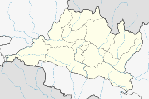
Khairahani
Khairahani Municipality
खैरहनी नगरपालिका [खै.न.पा.] | |
|---|---|
| Khairahani Municipality | |
| Nickname: Khairahani | |
| Coordinates: 27°34′16″N 84°34′16″E / 27.571°N 84.571°E | |
| Country | |
| Province | Bagmati |
| District | Chitwan |
| Government | |
| • Mayor | Sashi Kumar Khaniya (NC) |
| • Deputy Mayor | Kabita Upreti (कविता उप्रेती) (CPN-UML) |
| Population (1991) | |
| • Total | 13,629 |
| Time zone | UTC+5:45 (NST) |
| Area code | 056 |
| Website | www.khairhanimun.gov.np |
Khairahani is a municipality in Chitwan District in Bagmati Province of southern Nepal. The municipality was established on 8 May 2014 by merging the existing Khairahani, Kumroj and Chainpur VDCs.[1][2] At the time of the 1991 Nepal census it had a population of 13,629 people living in 2262 households.[3]
Demographics
[edit]At the time of the 2011 Nepal census, Khairahani Municipality had a population of 56,925. Of these, 60.2% spoke Nepali, 25.8% Tharu, 4.9% Darai, 2.7% Tamang, 2.1% Bhojpuri, 1.0% Magar, 0.9% Newar, 0.7% Gurung, 0.6% Maithili, 0.4% Hindi, 0.3% Chepang, 0.2% Bote, 0.1% Kham, 0.1% Urdu and 0.1% other languages as their first language.[4]
In terms of ethnicity/caste, 27.1% were Tharu, 25.7% Hill Brahmin, 14.1% Chhetri, 5.2% Darai, 4.3% Magar, 4.3% Tamang, 4.0% Newar, 3.0% Kami, 2.8% Gurung, 1.7% Damai/Dholi, 1.2% Musalman, 0.6% Kanu, 0.5% Bote, 0.5% Chepang/Praja, 0.5% Sanyasi/Dasnami, 0.5% Sarki, 0.4% Gharti/Bhujel, 0.3% Gaine, 0.3% Kumal, 0.3% Thakuri, 0.2% Dusadh/Pasawan/Pasi, 0.2% Majhi, 0.2% Musahar, 0.2% Rai, 0.2% Teli, 0.1% Chamar/Harijan/Ram, 0.1% Ghale, 0.1% Hajam/Thakur, 0.1% Halwai, 0.1% Kalwar, 0.1% Kathabaniyan, 0.1% Koiri/Kushwaha, 0.1% Mallaha, 0.1% other Terai, 0.1% Yadav and 0.1% others.[5]
In terms of religion, 89.7% were Hindu, 6.1% Buddhist, 2.5% Christian, 1.2% Muslim, 0.1% Prakriti and 0.4% others.[6]
Ward Profile
[edit]Presidents of Wards[7]
- Ward-no-1:Navaraj Bhusal (NC)
- Ward-no-2:Rohini Prasad Upreti (NC)
- Ward-no-3:Purna Bahadur Gurung (NC)
- Ward-no-4:Ved Bahadur Adhikari (CPN-UML)
- Ward-no-5:Chhatra Nath Subedi (CPN-UML)
- Ward-no-6:Kamal Prasad Neupane (CPN-UML)
- Ward-no-7:Maneger Mahato (CPN-UML)
- Ward-no-8:Shankar Kandel (NC)
- Ward-no-9:Bandhu Ram Mahato (CPN-UML)
- Ward-no-10:Chandra Vikram Chaudhary (NC)
- Ward-no-11:Dipendra Kumar Darai (CPN-UML)
- Ward-no-12:Kedar Nath Pant (NC)
- Ward-no-13:Kul Prasad Bhusal (CPN-UML)
References
[edit]- ^ "72 new municipalities announced". My Republica.com. Archived from the original on 2014-06-18. Retrieved 2014-06-10.
- ^ "Government announces 72 new municipalities". The Kathmandu Post. Archived from the original on 2014-10-06. Retrieved 2014-06-10.
- ^ "Nepal Census 2001". Nepal's Village Development Committees. Digital Himalaya. Archived from the original on 12 October 2008. Retrieved 14 December 2008.
- ^ NepalMap Language
- ^ NepalMap caste
- ^ NepalMap Religion
- ^ https://khairahanimun.gov.np/sites/khairahanimun.gov.np/files/documents/%E0%A4%B5%E0%A4%A1%E0%A4%BE%20%E0%A4%85%E0%A4%A7%E0%A5%8D%E0%A4%AF%E0%A4%95%E0%A5%8D%E0%A4%B7.pdf [bare URL PDF]


