Katunje, Dhading
Appearance
(Redirected from Katunge)
Katunje
कटुन्जे Katunje Bazar | |
|---|---|
 | |
| Country | |
| Zone | Bagmati Zone |
| District | Dhading District |
| Population (2011) | |
• Total | 5,906 |
| • Religions | Hindu Buddhism |
| Time zone | UTC+5:45 (Nepal Time) |
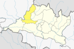
Katunje is a village development committee in Dhading District in the Bagmati Zone of central Nepal. At the time of the 2011 Nepal census it had a population of 5906 and had 1425 houses in it.[1]
The village is accessible from Dhading by dirt road (closed during monsoon season) and it takes around 1–2 hours to get to the village. In the monsoon season the road is closed and it is a 5–6 hour trek to the village.
There are at least 3-5 schools in the village. There is also an education initiative called Future Village [2] (a 2-storey cottage) for education of students.
References
[edit]- ^ "Nepal Census 2001". Nepal's Village Development Committees. Digital Himalaya. Archived from the original on 2008-10-12. Retrieved 2008-08-24.
- ^ "Future Village". Archived from the original on 2011-07-26. Retrieved 2010-10-20.
27°59′N 84°55′E / 27.983°N 84.917°E
http://ddcdhading.gov.np/wp-content/uploads/2016/07/ward-wise-pop-2011-dhading.pdf

