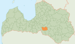
Jaunjelgava Municipality
Appearance
(Redirected from Jaunjelgavas novads)
Jaunjelgava Municipality
Jaunjelgavas novads | |
|---|---|
 | |
| Country | |
| Formed | 2009 |
| Centre | Jaunjelgava |
| Government | |
| • Chairman | Guntis Libeks (V) |
| Area | |
• Total | 684.64 km2 (264.34 sq mi) |
| • Land | 660.12 km2 (254.87 sq mi) |
| • Water | 24.52 km2 (9.47 sq mi) |
| Population (2021)[2] | |
• Total | 5,039 |
| • Density | 7.4/km2 (19/sq mi) |
| Website | www |
Jaunjelgava Municipality (Latvian: Jaunjelgavas novads) is a former municipality in Selonia, Latvia. The municipality was formed in 2009 by merging Sece parish, Sērene parish, Staburags parish, Sunākste parish and Jaunjelgava town with its countryside territory, with the administrative centre being Jaunjelgava. In 2010 Jaunjelgava parish was created from the countryside territory of Jaunjelgava town. The population in 2020 was 5,061.[3]
On 1 July 2021, Jaunjelgava Municipality ceased to exist and its territory was merged into Aizkraukle Municipality.[4]
See also
[edit]References
[edit]- ^ Central Statistical Bureau of Latvia https://data.stat.gov.lv/pxweb/lv/OSP_PUB/START__ENV__DR__DRT/DRT010/. Retrieved 25 February 2021.
{{cite web}}: Missing or empty|title=(help) - ^ Central Statistical Bureau of Latvia https://data.stat.gov.lv/pxweb/lv/OSP_PUB/START__POP__IR__IRS/IRD060/. Retrieved 15 June 2021.
{{cite web}}: Missing or empty|title=(help) - ^ "ISG020. Population number and its change by statistical region, city, town, 21 development centres and county". Central Statistical Bureau of Latvia. 2020-01-01. Retrieved 2021-02-12.
- ^ "Administratīvo teritoriju un apdzīvoto vietu likums". LIKUMI.LV (in Latvian). Retrieved 2024-08-08.


