Kidsgrove railway station
 | |||||
| General information | |||||
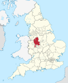
| Location | Kidsgrove, Borough of Newcastle-under-Lyme England | ||||
| Grid reference | SJ837543 | ||||
| Managed by | East Midlands Railway | ||||
| Platforms | 4 | ||||
| Bus routes | 95 Biddulph to Audley[1] | ||||
| Bus operators | D&G Bus[1] | ||||
| Other information | |||||
| Station code | KDG | ||||
| Classification | DfT category E | ||||
| Key dates | |||||
| 9 October 1848 | Opened as Harecastle[2] | ||||
| 2 October 1944 | renamed Kidsgrove Central[2] | ||||
| 18 April 1966 | renamed Kidsgrove[2] | ||||
| Passengers | |||||
| 2018/19 | |||||
| 2019/20 | |||||
| 2020/21 | |||||
| Interchange | 5,812 | ||||
| 2021/22 | |||||
| Interchange | | ||||
| 2022/23 | |||||
| Interchange | | ||||
| |||||
| |||||
Kidsgrove railway station serves the town of Kidsgrove in Staffordshire, England. The station is 7.5 miles (12.07 km) north of Stoke-on-Trent. The station is served by trains on the Crewe–Derby line which is also a community rail line known as the North Staffordshire line. The station is owned by Network Rail and managed by East Midlands Railway.
History
[edit]
The present station was opened 9 October 1848 by the North Staffordshire Railway as Harecastle and was during the early years of the North Staffordshire era variously called Harecastle Junction, Kidsgrove Junction. Kidsgrove Junction, Harecastle before settling upon Harecastle in 1875.[2] Between 1885 and 1886 and 1923 and 1924 it was called Harecastle for Kidsgrove.[2] In 1944 it was renamed Kidsgrove.
In British Rail days it was known as Kidsgrove Central when the town had three stations, the other two were Kidsgrove Liverpool Road and Market Street Halt on the old North Staffordshire Railway's Potteries Loop Line (all three stations were opened by the North Staffordshire Railway). It is situated on the Manchester branch of the West Coast Main Line at the junction where the line from Stoke-on-Trent divides for Crewe and Manchester Piccadilly.
It is just north of the Harecastle Tunnels on the Trent and Mersey Canal and the Harecastle railway tunnel and 1965 railway diversion.
Services
[edit]Services at Kidsgrove are operated by East Midlands Railway using Class 170 DMUs, London Northwestern Railway using Class 350 EMUs and Northern Trains using Class 323 and 331 EMUs.
The typical off-peak service in trains per hour is:
- 2 tph to Crewe
- 1 tph to Stafford[3]
- 1 tph to Newark Castle via Derby and Nottingham[4]
- 1 tph to Stoke-on-Trent only
- 1 tph to Manchester Piccadilly via Macclesfield[5]
On Sundays, the station is served by an hourly service between Crewe and Stafford and 6 trains per day between Manchester and Stoke-on-Trent. The first Manchester-bound train on a Sunday extends to Manchester Oxford Road. Hourly Sunday services operate between Crewe and Derby after 14:00 only.
| Preceding station | Following station | |||
|---|---|---|---|---|
| Longport or Stoke-on-Trent |
East Midlands Railway |
Alsager | ||
| London Northwestern Railway |
||||
| Northern Trains | ||||
| Historical railways | ||||
Line open, station closed | North Staffordshire Railway | Line and station closed |
||
Line open, station closed | North Staffordshire Railway | |||
Line and station closed | North Staffordshire Railway Sandbach to Stoke Line | |||
References
[edit]- ^ a b Walker, Melanie (25 January 2024). "Bus service can be used for 'fantastic day out'". Congleton Chronicle. p. 18.
- ^ a b c d e Quick, Michael (2009) [2001]. Railway passenger stations in Great Britain: a chronology (4th ed.). Oxford: Railway & Canal Historical Society. p. 231. ISBN 978-0-901461-57-5. OCLC 612226077.
- ^ "Timetable | Crewe to Stafford via Stoke-on-Trent | 10 December 2023 to 1 June 2024". London Northwestern Railway. 10 December 2023.
- ^ "EMR Regional Train Timetable | Crewe - Newark Castle". East Midlands Railway.
- ^ "N19 - Manchester to Stoke-on-Trent via Macclesfield | Train times | 10 December 2023 to 1 June 2024" (PDF). Northern Trains. Retrieved 19 December 2023.
External links
[edit]- Train times and station information for Kidsgrove railway station from National Rail
- Kidsgrove
- Railway stations in Staffordshire
- DfT Category E stations
- Former North Staffordshire Railway stations
- Railway stations in Great Britain opened in 1848
- Railway stations served by East Midlands Railway
- Railway stations served by Northern
- Rail junctions in England
- Railway stations served by West Midlands Trains


