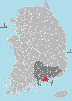
Goseong County, South Gyeongsang
Goseong
고성군 | |
|---|---|
| Korean transcription(s) | |
| • Hangul | 고성군 |
| • Hanja | 固城郡 |
| • Revised Romanization | Goseong-gun |
| • McCune-Reischauer | Kosŏng-gun |
 Location in South Korea | |
| Country | |
| Region | Yeongnam |
| Administrative divisions | 1 eup, 13 myeon |
| Area | |
• Total | 660.71 km2 (255.10 sq mi) |
| Population (September 2024[1]) | |
• Total | 48,356 |
| • Density | 116.8/km2 (303/sq mi) |
| • Dialect | Gyeongsang |
Goseong County (Goseong-gun) is a county in South Gyeongsang Province, South Korea.
Administrative divisions
[edit]Goseong-gun is divided into 1 eup and 13 myeon.
- Goseong-eup
- Daega-myeon
- Donghae-myeon
- Gaecheon-myeon
- Georyu-myeon
- Guman-myeon
- Hai-myeon
- Hail-myeon
- Heohwa-myeon
- Maan-myeon
- Samsan-myeon
- Sangri-myeon
- Yeonghyeon-myeon
- Yeongo-myeon
Location
[edit]Goseong-gun is located at the southern end of central Gyeongnam. It was the capital of Sogaya, an ancient kingdom of advanced culture.[2] It is endowed with natural tourism resources of beautiful mountains, ocean, and fields.
It is adjacent to Geoje, Sacheon, Tongyeong, Masan, and Jinju. It is also linked to the Daejeon-Tongyeong Expressway, National Roads No. 14 and No. 33.[3]
Climate
[edit]Its location is quite southern, which makes the climate mild and warm all year around. That is, Goseong is classified as an oceanic climate. The southeast wind blows during the summer and the northwest wind, which is the seasonal wind, blows during the winter.
Festival
[edit]Goseong was the center of the Gaya kingdom during ancient years. Goseong county held an annual "Sogaya festival" reemerging marching of ancient people with legends.
Additionally, events also deal with General Yi Sun-sin who beat Japanese invaders at Danghangpo which is near port of Goseong.[4]
Between 1 April and 12 June 2016, the county will host the Gyeongnam Goseong Dinosaur World Expo (see 'Fossil sites' below for more info).
Cluster
[edit]Goseong was designated as a cluster for shipbuilding, including development with its neighbor, Geoje area.
In July 2007, the Ministry of Finance and Economy confirmed the establishment of the complex after securing the land. The construction began in April 2008.[5]
Fossil sites
[edit]Goseong is known for, among other things, its fossilized dinosaur footprints. The county will host the Gyeongnam Goseong Dinosaur World Expo in 2016 for 73 days, between 1 April and 12 June, at Danghangpo Tourist Site and Sangjogam County Park. Goseong county participated in the International dinosaur festival of Zigong, Sichuan Province of China which is a sister city.
The whole area was on the way of propelling registration of UNESCO natural heritages with other southern coast-lying regions. Fossil sites on the southern coast of Korea are the largest scale in Asia.[6]
Tourist attractions
[edit]- Goseong Dinosaur Museum
- Sangjokam County Park[permanent dead link]
- Goseong Ogwangdae - Korea Mask Dance Drama
- Danghangpo Tourist Resort[permanent dead link]
- Mt. Yeonhwa Provincial Park[permanent dead link]
- Namsan Park
- Okcheon Temple
- Munsuam
- Songhakdong Gobungun - presumed to be tombs of political leaders of the Gaya period around A.D. 600.
- Unheung Temple
- Jangui Temple
- Mt. Geumtae Gyesung Temple
Agricultural and Marine Products
[edit]- Agricultural products: Dinosaur land rice, green pumpkin, hot pepper, sweet persimmon, pumpkin, chinamul, mushroom, cherry tomato, Goseong persimmon, strawberry
- Marine products: anchovy, Goseong Gaetjangeo (hamo) Hoe - raw fish, giant prawn, oyster.
Notable people
[edit]- Jung Jung-suk (1982-2011) was a South Korean women's football player.[7]
- Kim Cheong (1941–Present) is a poet and writer.[8]
- Yu Song-jin (born 1964/1965), South Korean engineer[9]
Sister cities
[edit]See also
[edit]- Sim Bong-geun, Goseong native and President of Dong-A University.
- Danghangpo Battle, a battle that happen in modern Danghang-ri, Hoehwa-myeon.
References
[edit]- ^ "Population statistics". Korea Ministry of the Interior and Safety. 2024.
- ^ 가야 지배자들의 무덤을 찾아서 Dayliannews http://www.dailian.co.kr/news/n_view.html?id=54195 2007.01.16
- ^ from County website
- ^ 고성 소가야문화제 개막 [Opening festival of Goseong]. Yonhap News Agency. 11 October 2006. Retrieved 10 August 2017.
- ^ 고성 조선산업특구 조성 4월 착공 [Goseong starting shipbuilding cluster from next April]. The Chosun Ilbo. 15 January 2008. Retrieved 10 August 2017.
- ^ 남해안 공룡화석지 국제심포지엄 개최 Newsis 2007-02-22 http://news.naver.com/main/read.nhn?mode=LSD&mid=sec&sid1=102&oid=003&aid=0000322959
- ^ "여자축구대표 출신 정정숙씨 별세". Yonhap News Agency. Naver. 2011-06-27.
- ^ "시간을 거슬러 순간을 붙들다". GosengNews. 2017-02-10.
- ^ "DPRK Says Probe Of Detained South Korean Underway". Turkish Weekly. 1 May 2009. Retrieved 22 October 2015.
External links
[edit]- County government website Archived 2017-10-10 at the Wayback Machine


