Fort Tombecbe
Fort Tombecbe | |
 Plan of Fort Tombecbe in March 1737 drawn by Ignace François Broutin. | |
| Location | Epes, Alabama |
|---|---|
| Coordinates | 32°41′53″N 88°7′4″W / 32.69806°N 88.11778°W |
| Built | 1736 |
| NRHP reference No. | 73000373 [1] |
| Added to NRHP | October 02, 1973 |
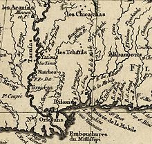
Fort Tombecbe (Fort de Tombecbé), also spelled Tombecbee and Tombeché, was a stockade fort located on the Tombigbee River near the border of French Louisiana, in what is now Sumter County, Alabama.[2] It was constructed under the leadership of Jean-Baptiste Le Moyne, Sieur de Bienville in 1736–1737 as trading post about 270 miles (430 km) upriver from Mobile, on an 80-foot (24 m) limestone bluff.[3] Fort Tombecbe was built in Choctaw lands and would play a major role in colonial France's efforts to stop British intrusions into the area. Bienville claimed that the new fort was to protect the Choctaw from the Chickasaw.[4] In May of 1736, Bienville, along with a force of 600 soldiers combined with a force of 600 Choctaw warriors, set out from Fort Tombecbe and attacked the Chickasaw near present-day Tupelo, Mississippi at the Battle of Ackia.[5] Tombecbe was a major French outpost and trade depot among the Choctaw, the largest Native American group in the colony.
Control passed to the British in 1763, who renamed it Fort York. In 1793 Spain acquired the site—by then the fort had been abandoned—from the Choctaw via the Treaty of Boukfouka and built a new fort, which was named Fort Confederación.[6] It is also known as Fort Confederation.[7] After the United States took possession, via the 1802 Treaty of Fort Confederation, it continued to be used as a trading post with the Choctaws until its eventual abandonment in the 19th century.[2]
The Fort Tombecbe site is currently owned by the University of West Alabama and the Archaeological Conservancy, and operated by the staff of the Black Belt Museum.[8]

See also
[edit]References
[edit]- ^ "National Register Information System". National Register of Historic Places. National Park Service. April 15, 2008.
- ^ a b "Fort Tombecbe". Dr. Joe Wilkins. alabamacanebrake.org. Archived from the original on 10 February 2010. Retrieved 2 December 2008.
- ^ "Le Moyne Brothers". Encyclopedia of Alabama. Retrieved 2 December 2008.
- ^ "Tombigbee History". RiversofAlabama.org. Archived from the original on 9 May 2008. Retrieved 2 December 2008.
- ^ "Fort Tombecbe History". Fort Tombecbe. Retrieved 7 November 2021.
- ^ Wells, Mary Ann (1994). Native land: Mississippi, 1540-1798. University Press of Mississippi. p. 196. ISBN 978-0-87805-734-4. Retrieved 25 March 2011.
- ^ Hudson, Charles M. (December 2007). Four Centuries of Southern Indians. University of Georgia Press. p. 71. ISBN 978-0-8203-3132-4. Retrieved 25 March 2011.
- ^ "Fort Tombecbe". Encyclopedia of Alabama. Retrieved 14 October 2011.
External links
[edit]


