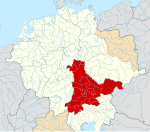
File:Zistanesfeld locator map (1000).svg
Appearance

Size of this PNG preview of this SVG file: 800 × 594 pixels. Other resolutions: 320 × 238 pixels | 640 × 476 pixels | 1,024 × 761 pixels | 1,280 × 951 pixels | 2,560 × 1,902 pixels | 1,615 × 1,200 pixels.
Original file (SVG file, nominally 1,615 × 1,200 pixels, file size: 5.33 MB)
File history
Click on a date/time to view the file as it appeared at that time.
| Date/Time | Thumbnail | Dimensions | User | Comment | |
|---|---|---|---|---|---|
| current | 12:14, 7 December 2016 |  | 1,615 × 1,200 (5.33 MB) | Alphathon | == {{int:filedesc}} == {{Inkscape}} {{Information |Description={{en|A map of the Gau of Zistanesfeld within the Duchy/March of Carinthia/Carantania around the year 1000. The map is derived from a v... |
File usage
The following page uses this file:
Global file usage
The following other wikis use this file:
- Usage on sl.wikipedia.org


