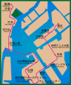
File:Yurikamome route map2020.svg
Appearance

Size of this PNG preview of this SVG file: 504 × 599 pixels. Other resolutions: 202 × 240 pixels | 404 × 480 pixels | 646 × 768 pixels | 862 × 1,024 pixels | 1,723 × 2,048 pixels | 770 × 915 pixels.
Original file (SVG file, nominally 770 × 915 pixels, file size: 275 KB)
File history
Click on a date/time to view the file as it appeared at that time.
| Date/Time | Thumbnail | Dimensions | User | Comment | |
|---|---|---|---|---|---|
| current | 12:47, 8 September 2020 |  | 770 × 915 (275 KB) | Nesnad | oops, noticed a second typo |
| 09:34, 7 September 2020 |  | 770 × 915 (269 KB) | Nesnad | oops typo | |
| 09:32, 7 September 2020 |  | 770 × 915 (260 KB) | Nesnad | {{Information |description=ゆりかもめ路線図 (Yurikamome Route Map) |date=2020-09-07 |source=File:Yurikamome route map.gif |author=Nesnad |permission= |other versions= }} Category:Yurikamome Category:Public transport maps of Tokyo Category:Rail transport maps of Japan |
File usage
The following page uses this file:
Global file usage
The following other wikis use this file:
- Usage on de.wikipedia.org
- Usage on th.wikipedia.org
- Usage on tr.wikipedia.org

