File:Wpdms usgs photo sacramento delta 2.jpg
Appearance
Wpdms_usgs_photo_sacramento_delta_2.jpg (700 × 520 pixels, file size: 81 KB, MIME type: image/jpeg)
File history
Click on a date/time to view the file as it appeared at that time.
| Date/Time | Thumbnail | Dimensions | User | Comment | |
|---|---|---|---|---|---|
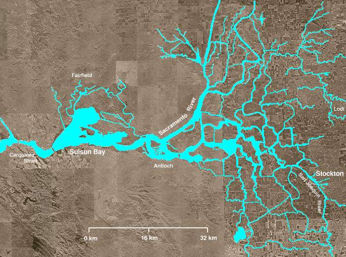
| current | 03:21, 8 August 2008 |  | 700 × 520 (81 KB) | Captndelta | {{Information |Description=The Sacramento-San Joaquin River Delta covers the right half of this image. The Sacramento River flows into the delta from the north and the San Joaquin River from the south. The Mokelumne River |
File usage
The following 7 pages use this file:
Global file usage
The following other wikis use this file:
- Usage on azb.wikipedia.org
- Usage on de.wikipedia.org
- Usage on es.wikipedia.org
- Usage on eu.wikipedia.org
- Usage on it.wikipedia.org
- Usage on ml.wikipedia.org
- Usage on nl.wikipedia.org
- Usage on www.wikidata.org


