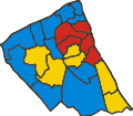
File:Wirral Local Election Map 2008.svg
Appearance

Size of this PNG preview of this SVG file: 495 × 432 pixels. Other resolutions: 275 × 240 pixels | 550 × 480 pixels | 880 × 768 pixels | 1,173 × 1,024 pixels | 2,347 × 2,048 pixels.
Original file (SVG file, nominally 495 × 432 pixels, file size: 216 KB)
File history
Click on a date/time to view the file as it appeared at that time.
| Date/Time | Thumbnail | Dimensions | User | Comment | |
|---|---|---|---|---|---|
| current | 06:52, 17 June 2011 |  | 495 × 432 (216 KB) | OgreBot | (BOT): Reverting to the most recent version before uploads (originally uploaded on 2009-01-10 01:57 by ZooFari). |
| 06:51, 17 June 2011 |  | 1,052 × 744 (216 KB) | OgreBot | (BOT): This is the version originally uploaded on 2008-12-14 03:47 by ZooFari; storing on commons for archival purposes | |
| 19:38, 16 June 2011 |  | 495 × 432 (216 KB) | File Upload Bot (Magnus Manske) | {{BotMoveToCommons|en.wikipedia|year={{subst:CURRENTYEAR}}|month={{subst:CURRENTMONTHNAME}}|day={{subst:CURRENTDAY}}}} {{Information |Description={{en|A map of the Wirral showing all the wards according to which political party carried the ward at the Wi |
File usage
The following page uses this file:

