From Wikipedia, the free encyclopedia

No higher resolution available.
Summary
Licensing
| Public domainPublic domainfalsefalse
|
Original upload log
The original description page was
here. All following user names refer to en.wikipedia.
| Date/Time |
Dimensions |
User |
Comment
|
| 2010-05-02 01:10:34 |
217× 378× |
Sumsum2010 |
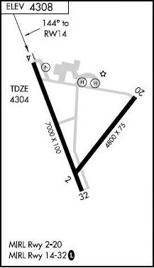
{{Information |Description = The diagram for [[Winnemucca Municiple airport]]. |Source = http://flightaware.com/resources/airport/WMC/IAP/RNAV+(GPS)+RWY+14/pdf |Date = ~~~~~ |Author = FAA |Permission = |other_versio
|
Add a one-line explanation of what this file represents
File history
Click on a date/time to view the file as it appeared at that time.
| Date/Time | Thumbnail | Dimensions | User | Comment |
|---|
| current | 20:09, 5 November 2016 |  | 217 × 378 (20 KB) | FastilyClone | Transferred from en.wikipedia (MTC!) |
File usage
The following 2 pages use this file:
Global file usage
The following other wikis use this file:
- Usage on tg.wikipedia.org
This file contains additional information, probably added from the digital camera or scanner used to create or digitize it.
If the file has been modified from its original state, some details may not fully reflect the modified file.


