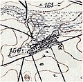
File:Wieś przed komasacją -1897.jpg
Appearance

Size of this preview: 604 × 600 pixels. Other resolutions: 242 × 240 pixels | 483 × 480 pixels | 862 × 856 pixels.
Original file (862 × 856 pixels, file size: 230 KB, MIME type: image/jpeg)
File history
Click on a date/time to view the file as it appeared at that time.
| Date/Time | Thumbnail | Dimensions | User | Comment | |
|---|---|---|---|---|---|
| current | 04:42, 5 October 2015 |  | 862 × 856 (230 KB) | Magog the Ogre | Reverted to version as of 13:06, 13 April 2011 (UTC) |
| 18:21, 4 October 2015 |  | 450 × 332 (74 KB) | Kainel Kemezrp | wikikradzież stop | |
| 13:06, 13 April 2011 |  | 862 × 856 (230 KB) | Kainel Kemezrp | {{Information |Description ={{pl|1=Opracowany fragment niemieckiej mapy z roku 1897, przedstawiający topografię wsi Wypnicha.}} |Source =Karte des westlichen Rußlands L 37 Lublin Sud |Author = Königlich Preußischen Landesaufnahme |
File usage
The following page uses this file:
Global file usage
The following other wikis use this file:
- Usage on pl.wikipedia.org
