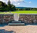
File:Wicklow Way Marlay Park Trailhead.jpg
Appearance

Size of this preview: 674 × 599 pixels. Other resolutions: 270 × 240 pixels | 540 × 480 pixels | 864 × 768 pixels | 1,152 × 1,024 pixels | 2,304 × 2,048 pixels | 3,142 × 2,793 pixels.
Original file (3,142 × 2,793 pixels, file size: 4.41 MB, MIME type: image/jpeg)
File history
Click on a date/time to view the file as it appeared at that time.
| Date/Time | Thumbnail | Dimensions | User | Comment | |
|---|---|---|---|---|---|
| current | 19:40, 1 September 2011 |  | 3,142 × 2,793 (4.41 MB) | Joe King | Better lit version of the subject |
| 13:29, 14 May 2011 |  | 2,709 × 2,408 (2.29 MB) | Joe King | {{Information |Description ={{en|1=The trailhead of the Wicklow Way in Marlay Park, County Dublin, Ireland. The Wicklow Way is a 132km long-distance National Waymarked Trail that runs from Marlay Park across County Wicklow and ends at Clonegal in Count |
File usage
The following 2 pages use this file:
Global file usage
The following other wikis use this file:
- Usage on de.wikipedia.org
- Usage on fr.wikipedia.org
- Usage on pl.wikipedia.org
- Usage on www.wikidata.org
