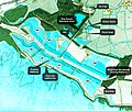
File:Wetlands map.jpg
Appearance

Size of this preview: 714 × 599 pixels. Other resolutions: 286 × 240 pixels | 572 × 480 pixels | 915 × 768 pixels | 1,220 × 1,024 pixels | 1,402 × 1,177 pixels.
Original file (1,402 × 1,177 pixels, file size: 1.45 MB, MIME type: image/jpeg)
File history
Click on a date/time to view the file as it appeared at that time.
| Date/Time | Thumbnail | Dimensions | User | Comment | |
|---|---|---|---|---|---|
| current | 17:37, 19 April 2015 |  | 1,402 × 1,177 (1.45 MB) | Imagesincommons | Amended label |
| 17:21, 19 April 2015 |  | 1,404 × 1,179 (1.45 MB) | Imagesincommons | Amended label | |
| 20:11, 18 April 2015 |  | 1,408 × 1,178 (665 KB) | Imagesincommons | Changed education centre to education zone | |
| 19:58, 18 April 2015 |  | 1,411 × 1,183 (677 KB) | Imagesincommons | Reduced font size | |
| 19:46, 18 April 2015 |  | 1,408 × 1,181 (674 KB) | Imagesincommons | Improved detail | |
| 14:51, 18 April 2015 |  | 3,050 × 2,264 (1.87 MB) | Imagesincommons | User created page with UploadWizard |
File usage
The following page uses this file:
