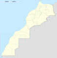
File:Western Sahara location map blank.svg
Appearance

Size of this PNG preview of this SVG file: 677 × 600 pixels. Other resolutions: 271 × 240 pixels | 542 × 480 pixels | 867 × 768 pixels | 1,156 × 1,024 pixels | 2,312 × 2,048 pixels | 1,472 × 1,304 pixels.
Original file (SVG file, nominally 1,472 × 1,304 pixels, file size: 115 KB)
File history
Click on a date/time to view the file as it appeared at that time.
| Date/Time | Thumbnail | Dimensions | User | Comment | |
|---|---|---|---|---|---|
| current | 18:47, 21 October 2019 |  | 1,472 × 1,304 (115 KB) | Sting | == {{int:filedesc}} == {{Location|24|27|00|N|12|51|00|W|scale:3000000}} {{Information |Description= {{en|Blank administrative map of {{W|Western Sahara}} without internal boundaries, for geo-location purposes.}} Equirectangular projection, WGS84 datum<br/> *Central meridian: 012° 51' W<br/> *Standard parallel: 24° 27' N<br/> Geographic limits of the map:<br/> *Top: 28° 12' N<br/> *Bottom: 20° 42' N<br/> *Left: 017° 30' W<br/> *Right: 008° 12' W |Source=[[:File:Western_Sahara_location_map.svg]... |
File usage
The following page uses this file:
Global file usage
The following other wikis use this file:


