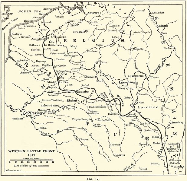
File:WesternFront1917.jpg
Appearance

Size of this preview: 618 × 600 pixels. Other resolutions: 247 × 240 pixels | 495 × 480 pixels | 792 × 768 pixels | 1,144 × 1,110 pixels.
Original file (1,144 × 1,110 pixels, file size: 239 KB, MIME type: image/jpeg)
File history
Click on a date/time to view the file as it appeared at that time.
| Date/Time | Thumbnail | Dimensions | User | Comment | |
|---|---|---|---|---|---|
| current | 07:53, 6 November 2007 |  | 1,144 × 1,110 (239 KB) | Rcbutcher | {{Information |Description=Map of The Western Front in 1917. |Source=THE GEOGRAPHY OF THE GREAT WAR BY FRANK M. McMURRY, PH.D. New York THE MACMILLAN CO. 1919 <br>Provided with the kind permission of Ms. Darlene McClendon at http://freepages.military.root |
File usage
No pages on the English Wikipedia use this file (pages on other projects are not listed).
Global file usage
The following other wikis use this file:
- Usage on ar.wikipedia.org
- Usage on en.wikinews.org
- Usage on eo.wikipedia.org
- Usage on fi.wikipedia.org
- Usage on he.wikipedia.org
- Usage on id.wikipedia.org
- Usage on it.wikipedia.org
- Usage on ja.wikipedia.org
- Usage on pt.wikipedia.org
- Usage on sr.wikipedia.org
- Usage on sv.wikipedia.org
- Usage on tr.wikipedia.org
- Usage on vi.wikipedia.org
- Usage on zh.wikipedia.org


