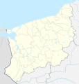
File:West Pomeranian Voivodeship location map.svg
Appearance

Size of this PNG preview of this SVG file: 570 × 600 pixels. Other resolutions: 228 × 240 pixels | 456 × 480 pixels | 730 × 768 pixels | 974 × 1,024 pixels | 1,947 × 2,048 pixels | 2,200 × 2,314 pixels.
Original file (SVG file, nominally 2,200 × 2,314 pixels, file size: 1,018 KB)
File history
Click on a date/time to view the file as it appeared at that time.
| Date/Time | Thumbnail | Dimensions | User | Comment | |
|---|---|---|---|---|---|
| current | 16:16, 21 January 2023 |  | 2,200 × 2,314 (1,018 KB) | SANtosito | Update |
| 23:16, 17 June 2018 |  | 2,200 × 2,314 (1.01 MB) | SANtosito | {{Information |description ={{en|1=Location maps of West Pomeranian Voivodeship}} |date =2018-06-17 |source =Own work |author =Santosito |permission =Own work }} |
File usage
The following 13 pages use this file:
- Choyna Air Base
- Kluczewo Airfield
- Kozia Góra, Stargard County
- Kołobrzeg-Bagicz Airfield
- Międzyzdroje Pier
- Nowe Kunowo
- Orle, Wałcz County
- Orzechy
- Piaszczyte, Stargard County
- Załęcze, West Pomeranian Voivodeship
- Module:Location map/data/Poland West Pomeranian Voivodeship
- Module:Location map/data/Poland West Pomeranian Voivodeship/doc
- Module:Location map/data/West Pomeranian Voivodeship
Global file usage
The following other wikis use this file:
- Usage on de.wikipedia.org
- Flugplatz Stettin
- Florian-Krygier-Stadion
- Wicko Małe
- Leuchtturm Jarosławiec
- Leuchtturm Kikut
- Fliegerhorst Königsberg-Neumark
- Flugplatz Makowice-Płoty
- Leuchtturm Niechorze
- Leuchtturm Świnoujście
- Leuchtturm Kołobrzeg
- Miniaturpark der Leuchttürme
- Vorlage:Positionskarte Polen Westpommern
- Militärflugplatz Mirosławiec
- Warenhaus Rudolph Karstadt (Stettin)
- Warenkaufhaus Aronheim & Cohn (Stettin)
- Leuchtturm Gąski
- Hanza Tower
- Leuchtturm Darłowo
- Netto Arena
- Mühlenbake
- Usage on fa.wikipedia.org
- Usage on fr.wikipedia.org
- Koszalin
- Liste des commanderies templières en Poméranie occidentale
- Cedynia
- Mieszkowice
- Mielno (Koszalin)
- Stade municipal de Szczecin
- Nowogard
- Modèle:Géolocalisation/Poméranie-Occidentale (Pologne)
- Commanderie de Czaplinek
- Modèle:Géolocdual/Poméranie-Occidentale (Pologne)
- Modèle:Carte/Poméranie-Occidentale (Pologne)
- Połczyn-Zdrój
- Sławno (gmina, Poméranie-Occidentale)
- Banie (gmina)
- Barlinek (gmina)
- Barwice (gmina)
- Będzino (gmina)
- Biały Bór (gmina)
- Bielice (gmina)
- Bierzwnik (gmina)
- Bobolice (gmina)
- Boleszkowice (gmina)
View more global usage of this file.
