File:Wells Gray-Clearwater Volcanic Field-en.svg
Appearance

Size of this PNG preview of this SVG file: 558 × 600 pixels. Other resolutions: 223 × 240 pixels | 446 × 480 pixels | 714 × 768 pixels | 953 × 1,024 pixels | 1,905 × 2,048 pixels | 2,000 × 2,150 pixels.
Original file (SVG file, nominally 2,000 × 2,150 pixels, file size: 1.71 MB)
File history
Click on a date/time to view the file as it appeared at that time.
| Date/Time | Thumbnail | Dimensions | User | Comment | |
|---|---|---|---|---|---|
| current | 09:49, 13 June 2008 |  | 2,000 × 2,150 (1.71 MB) | Sémhur | Typography : cone => Cone |
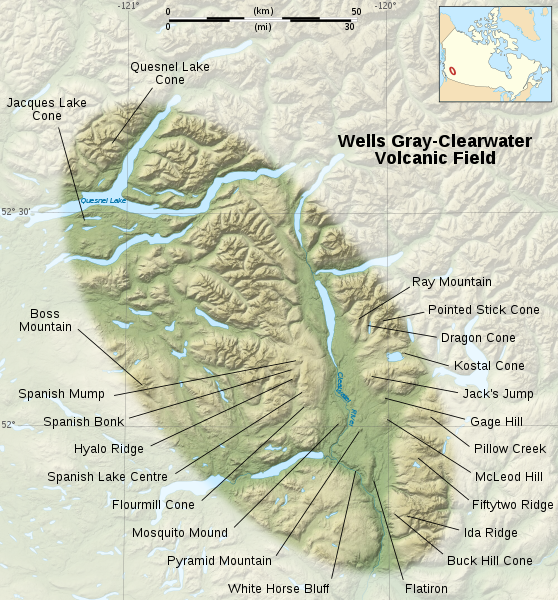
| 19:19, 12 June 2008 |  | 2,000 × 2,150 (1.71 MB) | Sémhur | == Description == {{Information| Description= {{en}}Map of the Wells Gray-Clearwater Volcanic Field, a range of volcanoes in British Columbia, Canada. {{fr}}Carte de la chaîne volcanique de Wells Gray-Clearwater, une suite de volcans de Colombie Britann |
File usage
The following page uses this file:
