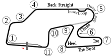
File:Watkins Glen International Circuit Map.png
Appearance

Size of this preview: 800 × 403 pixels. Other resolutions: 320 × 161 pixels | 640 × 322 pixels | 999 × 503 pixels.
Original file (999 × 503 pixels, file size: 148 KB, MIME type: image/png)
File history
Click on a date/time to view the file as it appeared at that time.
| Date/Time | Thumbnail | Dimensions | User | Comment | |
|---|---|---|---|---|---|
| current | 22:37, 15 October 2009 |  | 999 × 503 (148 KB) | Spyder Monkey | Corrected turn numbers and names (inner loop, outer loop) |
| 05:22, 6 June 2008 |  | 999 × 509 (148 KB) | Will Pittenger | {{Information |Description=New version based on Image:Watkins_Glen_International_Track_Map.svg with white borders on some objects in case the background isn't white. New version adds the bus stop. The PNG version was updated for users of browsers l | |
| 18:23, 29 November 2006 |  | 470 × 490 (20 KB) | Aconcagua | Watkins Glen International Circuit Map {{Moved to commons|lt|Arz|21:42, 2006 Rugpjūčio 3}} {{PD-user-lt|Arz}} Category:Formula One circuits maps |
File usage
The following 2 pages use this file:
Global file usage
The following other wikis use this file:
- Usage on ca.wikipedia.org
- Usage on cs.wikipedia.org
- Usage on de.wikipedia.org
- Usage on fi.wikipedia.org
- Usage on fr.wikipedia.org
- Usage on gl.wikipedia.org
- Usage on hu.wikipedia.org
- Usage on id.wikipedia.org
- Usage on pl.wikipedia.org
- Usage on pt.wikipedia.org
- Usage on ru.wikipedia.org
- Usage on sl.wikipedia.org


