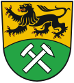
File:Wappen Erzgebirgskreis.svg
Appearance

Size of this PNG preview of this SVG file: 512 × 569 pixels. Other resolutions: 216 × 240 pixels | 432 × 480 pixels | 691 × 768 pixels | 921 × 1,024 pixels | 1,843 × 2,048 pixels.
Original file (SVG file, nominally 512 × 569 pixels, file size: 16 KB)
File history
Click on a date/time to view the file as it appeared at that time.
| Date/Time | Thumbnail | Dimensions | User | Comment | |
|---|---|---|---|---|---|
| current | 20:37, 7 June 2019 |  | 512 × 569 (16 KB) | Habitator terrae | change coding, because of problem in firefox: only see text |
| 10:42, 3 June 2016 |  | 512 × 569 (16 KB) | Ludger1961 | optimiert, N="#000" W="#fff" | |
| 20:52, 21 September 2012 |  | 512 × 569 (24 KB) | Ludger1961 | http://www.erzgebirgskreis.de/uploads/media/wappen_format_eps_03.zip auf http://www.erzgebirgskreis.de/index.php?id=8276&K=1&tx_ttnews[backPid]=8179&tx_ttnews[tt_news]=3785&cHash=5d8ddedeffd17a15f323ce052c46a8a9 | |
| 16:03, 12 February 2010 |  | 188 × 209 (25 KB) | File Upload Bot (Magnus Manske) | {{BotMoveToCommons|de.wikipedia|year={{subst:CURRENTYEAR}}|month={{subst:CURRENTMONTHNAME}}|day={{subst:CURRENTDAY}}}} {{Information |Description={{de|Wappen des Erzgebirgskreises}} |Source=Transferred from [http://de.wikipedia.org de.wikipedia]; transfe |
File usage
The following 80 pages use this file:
- Amtsberg
- Annaberg-Buchholz
- Aue-Bad Schlema
- Auerbach, Erzgebirgskreis
- Bockau
- Borstendorf
- Breitenbrunn, Saxony
- Burkhardtsdorf
- Bärenstein
- Börnichen
- Crottendorf
- Deutscheinsiedel
- Deutschneudorf
- Drebach
- Ehrenfriedersdorf
- Eibenstock
- Elterlein
- Erlbach-Kirchberg
- Erzgebirgskreis
- Frohnau (Annaberg-Buchholz)
- Gelenau
- Geyer
- Gornau
- Gornsdorf
- Grießbach
- Großolbersdorf
- Großrückerswalde
- Grünhain-Beierfeld
- Grünhainichen
- Heidersdorf
- Hirtstein (municipality)
- Hohndorf
- Hormersdorf
- Jahnsdorf
- Johanngeorgenstadt
- Jöhstadt
- Krumhermersdorf
- Königswalde
- Lauter-Bernsbach
- Lengefeld
- Lugau
- Lößnitz
- Marienberg
- Mildenau
- Neukirchen, Erzgebirgskreis
- Niederdorf, Saxony
- Niederwürschnitz
- Oberwiesenthal
- Oelsnitz, Erzgebirge
- Olbernhau
- Pfaffroda
- Pobershau
- Pockau
- Pockau-Lengefeld
- Raschau-Markersbach
- Scheibenberg
- Schlettau
- Schneeberg, Saxony
- Schwarzenberg, Saxony
- Schönheide
- Sehmatal
- Seiffen
- Stollberg
- Stützengrün
- Tannenberg, Saxony
- Thalheim, Saxony
- Thermalbad Wiesenbad
- Thum
- Venusberg, Saxony
- Waldkirchen, Saxony
- Wildenthal (Eibenstock)
- Wolkenstein
- Zschopau
- Zschorlau
- Zwönitz
- Zöblitz
- User:Daniel Maak/sandbox
- Wikipedia:WikiProject Germany/Cities/Saxony
- Template:Cities and towns in Erzgebirgskreis
- Template:Erzgebirgskreis-geo-stub
Global file usage
The following other wikis use this file:
- Usage on ca.wikipedia.org
- Usage on cs.wikipedia.org
- Bärenstein (Sasko)
- Oberwiesenthal
- Deutschneudorf
- Schlettau
- Marienberg
- Schwarzenberg (Sasko)
- Seiffen
- Annaberg-Buchholz
- Schneeberg (Sasko)
- Großolbersdorf
- Šablona:Zemský okres Krušné hory
- Česko-německá státní hranice
- Olbernhau
- Johanngeorgenstadt
- Jöhstadt
- Wikipedista:Loktušák77/Pískoviště
- Aue-Bad Schlema
- Oelsnitz/Erzgeb.
- Zemský okres Krušné hory
- Diskuse ke kategorii:Navigační šablony německých zemských okresů
- Sehmatal
- Breitenbrunn/Erzgeb.
- Wolkenstein
- Zschopau
- Seznam zemských a městských okresů v Sasku
- Stollberg/Erzgeb.
- Geyer (Německo)
- Tannenberg (Sasko)
- Usage on da.wikipedia.org
- Usage on de.wikipedia.org
View more global usage of this file.


