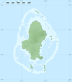
File:Wallis-et-Futuna collectivity location map.svg
Appearance

Size of this PNG preview of this SVG file: 800 × 508 pixels. Other resolutions: 320 × 203 pixels | 640 × 406 pixels | 1,024 × 650 pixels | 1,280 × 813 pixels | 2,560 × 1,626 pixels | 1,691 × 1,074 pixels.
Original file (SVG file, nominally 1,691 × 1,074 pixels, file size: 89 KB)
File history
Click on a date/time to view the file as it appeared at that time.
| Date/Time | Thumbnail | Dimensions | User | Comment | |
|---|---|---|---|---|---|
| current | 21:03, 12 July 2010 |  | 1,691 × 1,074 (89 KB) | Sting | == {{int:filedesc}} == {{Location|13|46|30|S|177|10|30|W|scale:1000000}} <br/> {{Information |Description={{en|Blank administrative map of the French overseas collectivity of Wallis and Futuna |
File usage
The following 4 pages use this file:
Global file usage
The following other wikis use this file:
- Usage on af.wikipedia.org
- Usage on als.wikipedia.org
- Usage on an.wikipedia.org
- Usage on ar.wikipedia.org
- Usage on ast.wikipedia.org
- Usage on az.wikipedia.org
- Usage on bg.wikipedia.org
- Usage on bs.wikipedia.org
- Usage on ceb.wikipedia.org
- Plantilya:Location map Wallis and Futuna
- North Point
- Rocky Point
- Sail Rock
- Green Point
- Red Point
- Entrance Island
- Tepa (pagklaro)
- Wallis Island
- Pasco Reef
- Little Peak
- Pointe Rouge
- Liku
- Vele
- Alo
- Pointe Verte
- Kolia
- Lac Lano
- Pointe Nord
- Southwest Rock
- The Lions
- Combe Bank
- Petit Piton
- Pointe Falaise
- Mamelon Vert
- Ouvéa
- Halalo
- Gahi
- Akaka
- Alele
- Vaitupu
- Nukufetau
- Lulu Hill
- Les Lions
- Île Futuna
- Waterwitch Seamount
- Taviuni Reef
- Rotumah Reef
View more global usage of this file.


