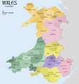
File:WalesCantrefiMap.png
Appearance

Size of this preview: 564 × 599 pixels. Other resolutions: 226 × 240 pixels | 452 × 480 pixels | 723 × 768 pixels | 964 × 1,024 pixels | 2,354 × 2,501 pixels.
Original file (2,354 × 2,501 pixels, file size: 782 KB, MIME type: image/png)
File history
Click on a date/time to view the file as it appeared at that time.
| Date/Time | Thumbnail | Dimensions | User | Comment | |
|---|---|---|---|---|---|
| current | 17:23, 25 September 2020 |  | 2,354 × 2,501 (782 KB) | XrysD | Fixed typo Maelien-->Maelienydd |
| 18:03, 17 January 2019 |  | 2,354 × 2,501 (780 KB) | XrysD | Fixed typo Penilyn==>Penllyn | |
| 20:01, 29 April 2018 |  | 2,354 × 2,501 (860 KB) | XrysD | User created page with UploadWizard |
File usage
The following page uses this file:
Global file usage
The following other wikis use this file:
- Usage on ca.wikipedia.org
- Usage on da.wikipedia.org
- Usage on fr.wikipedia.org
- Usage on id.wikipedia.org
- Usage on ko.wikipedia.org
- Usage on no.wikipedia.org
- Usage on pt.wikipedia.org
- Usage on ru.wikipedia.org
