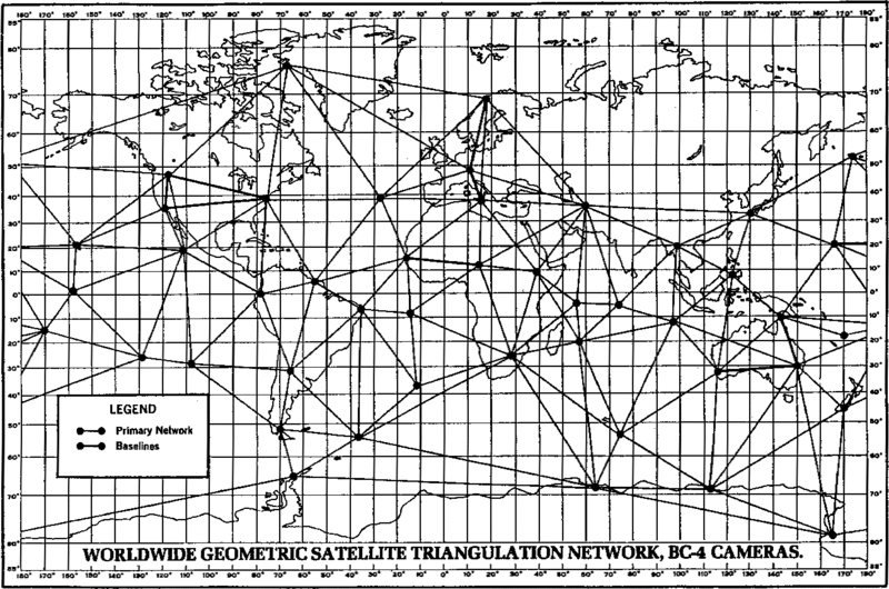
File:WORLDWIDE GEOMETRIC SATELLITE TRIANGULATION NETWORK, BC-4 CAMERAS.GIF
Appearance

Size of this preview: 800 × 530 pixels. Other resolutions: 320 × 212 pixels | 640 × 424 pixels | 1,024 × 678 pixels | 1,322 × 875 pixels.
Original file (1,322 × 875 pixels, file size: 121 KB, MIME type: image/gif)
File history
Click on a date/time to view the file as it appeared at that time.
| Date/Time | Thumbnail | Dimensions | User | Comment | |
|---|---|---|---|---|---|
| current | 16:21, 30 May 2013 |  | 1,322 × 875 (121 KB) | Quibik | Clearer version from http://www.ngs.noaa.gov/PUBS_LIB/GeoLay.pdf p. 88. Deskewed and cropped. |
| 03:54, 19 August 2007 |  | 650 × 447 (21 KB) | Gunnaraztek | {{Information |Description=taken from the public domain booklet Geodesy for the Layman at http://www.ngs.noaa.gov/PUBS_LIB/Geodesy4Layman/TR80003E.HTM#ZZ11 |Source=Originally from [http://en.wikipedia.org en.wikipedia]; description page is/was [http://en. |
File usage
The following 3 pages use this file:
Global file usage
The following other wikis use this file:
- Usage on ar.wikipedia.org
- Usage on ca.wikipedia.org
- Usage on eo.wikipedia.org
- Usage on es.wikipedia.org
- Usage on fr.wikipedia.org
- Usage on it.wikipedia.org
- Usage on ko.wikipedia.org
- Usage on ru.wikipedia.org
- Usage on sr.wikipedia.org


