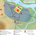
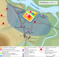
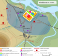
File:Vindobona 250-300.svg
Appearance

Size of this PNG preview of this SVG file: 626 × 599 pixels. Other resolutions: 251 × 240 pixels | 502 × 480 pixels | 803 × 768 pixels | 1,070 × 1,024 pixels | 2,140 × 2,048 pixels | 1,116 × 1,068 pixels.
Original file (SVG file, nominally 1,116 × 1,068 pixels, file size: 268 KB)
File history
Click on a date/time to view the file as it appeared at that time.
| Date/Time | Thumbnail | Dimensions | User | Comment | |
|---|---|---|---|---|---|
| current | 11:49, 3 May 2014 |  | 1,116 × 1,068 (268 KB) | Rosso Robot | small corrs |
| 11:30, 3 May 2014 |  | 1,116 × 1,068 (268 KB) | Rosso Robot | more quiet colours, +Map symbology, +small fixes | |
| 08:47, 25 September 2009 |  | 1,110 × 900 (223 KB) | Linksnet | something went wrong - here comes the corrected file | |
| 08:44, 25 September 2009 |  | 1,110 × 900 (223 KB) | Linksnet | moved legend to description, so the map is completely visible | |
| 14:41, 9 June 2009 |  | 1,110 × 900 (90 KB) | Rosso Robot | {{Information |Description={{de|Lageplan von de:Vindobona (''heute:de:Wien'')}} {{en|map of the area en:Vindobona (''today:en:Vienna'')}} |Source=Transferred from [http://de.wikipedia.org de.wikipedia]<br/> (Original text : ''* [ht |
File usage
The following page uses this file:
Global file usage
The following other wikis use this file:
- Usage on bg.wikipedia.org
- Usage on de.wikipedia.org
- Vindobona
- Benutzer:Rosso Robot
- Legio X Gemina
- Benutzer:Invisigoth67/Wien
- Benutzer:Rosso Robot/Infobox Wienarch
- Wikipedia:Kartenwerkstatt/Archiv/2009-06
- Wikipedia:Grafikwerkstatt/Archiv/2009/September
- Wikipedia:Fotowerkstatt/Archiv/2009/September
- Wikipedia:Redaktion Altertum/Römischer Limes/Pictothek/Oberpannonischer Limes
- Usage on de.wikiversity.org
- Usage on es.wikipedia.org
- Usage on eu.wikipedia.org
- Usage on gl.wikipedia.org
- Usage on id.wikipedia.org
- Usage on it.wikipedia.org
- Usage on ja.wikipedia.org
- Usage on ka.wikipedia.org
- Usage on lb.wikipedia.org
- Usage on lv.wikipedia.org
- Usage on nl.wikipedia.org
- Usage on no.wikipedia.org
- Usage on pl.wikipedia.org
- Usage on pt.wikipedia.org
- Usage on ro.wikipedia.org
- Usage on ru.wikipedia.org
- Usage on sh.wikipedia.org
- Usage on sl.wikipedia.org
- Usage on sr.wikipedia.org
- Usage on uk.wikipedia.org


