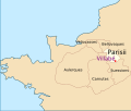
File:Villabé - Carte gaulois.svg
Appearance

Size of this PNG preview of this SVG file: 706 × 600 pixels. Other resolutions: 283 × 240 pixels | 565 × 480 pixels | 904 × 768 pixels | 1,205 × 1,024 pixels | 2,411 × 2,048 pixels | 1,423 × 1,209 pixels.
Original file (SVG file, nominally 1,423 × 1,209 pixels, file size: 61 KB)
File history
Click on a date/time to view the file as it appeared at that time.
| Date/Time | Thumbnail | Dimensions | User | Comment | |
|---|---|---|---|---|---|
| current | 23:18, 9 January 2015 |  | 1,423 × 1,209 (61 KB) | Poudou99 | Augmentation de la taille des noms |
| 23:04, 9 January 2015 |  | 1,423 × 1,209 (68 KB) | Poudou99 | Avec couleurs recommandées (http://fr.wikipedia.org/wiki/Aide:Cartographie#Conventions_et_Recommandations) | |
| 00:19, 9 January 2015 |  | 1,423 × 1,209 (64 KB) | Poudou99 | Deuxième tentative | |
| 00:11, 9 January 2015 |  | 1,423 × 1,209 (61 KB) | Poudou99 | tentative pour enlever le rectangle noir | |
| 23:53, 8 January 2015 |  | 1,423 × 1,209 (59 KB) | Poudou99 | User created page with UploadWizard |
File usage
The following page uses this file:
Global file usage
The following other wikis use this file:
- Usage on ar.wikipedia.org
- Usage on ca.wikipedia.org
- Usage on fr.wikipedia.org
- Usage on he.wikipedia.org
- Usage on mi.wikipedia.org
- Usage on pl.wikipedia.org
- Usage on ur.wikipedia.org
- Usage on www.wikidata.org
