File:Via Popilia map.jpg
Appearance

Size of this preview: 569 × 600 pixels. Other resolutions: 228 × 240 pixels | 455 × 480 pixels | 729 × 768 pixels | 1,052 × 1,109 pixels.
Original file (1,052 × 1,109 pixels, file size: 642 KB, MIME type: image/jpeg)
File history
Click on a date/time to view the file as it appeared at that time.
| Date/Time | Thumbnail | Dimensions | User | Comment | |
|---|---|---|---|---|---|
| current | 11:20, 28 January 2008 |  | 1,052 × 1,109 (642 KB) | Salli~commonswiki | |
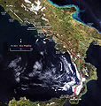
| 19:54, 4 April 2007 |  | 1,052 × 1,109 (647 KB) | Salli~commonswiki | {{en|Map of the Popilian Way (or Via Capua-Rhegium) conjuncted to Appian Way.}} {{it|Mappa della Via Popilia (o Via Capua-Rhegium) collegata alla Via Appia.}} == Summary == This map is based on the following pictur |
File usage
The following page uses this file:
Global file usage
The following other wikis use this file:
- Usage on bg.wikipedia.org
- Usage on da.wikipedia.org
- Usage on de.wikipedia.org
- Usage on fr.wikipedia.org
- Usage on it.wikipedia.org
- Usage on ja.wikipedia.org
- Usage on la.wikipedia.org
- Usage on mk.wikipedia.org
- Usage on pt.wikipedia.org
- Usage on sl.wikipedia.org
- Usage on sv.wikipedia.org


