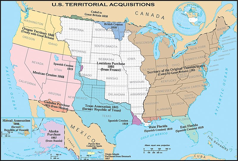
File:Us historic territories.jpg
Appearance

Size of this preview: 800 × 542 pixels. Other resolutions: 320 × 217 pixels | 640 × 434 pixels | 1,024 × 694 pixels | 1,280 × 868 pixels | 1,550 × 1,051 pixels.
Original file (1,550 × 1,051 pixels, file size: 1.24 MB, MIME type: image/jpeg)
File history
Click on a date/time to view the file as it appeared at that time.
| Date/Time | Thumbnail | Dimensions | User | Comment | |
|---|---|---|---|---|---|
| current | 07:29, 19 February 2006 |  | 1,550 × 1,051 (1.24 MB) | Aude | United States historic territory acquisitions Source: [http://www.nationalatlas.gov/ USGS National Atlas] Text labels modified (increased size), cropped, and converted to svg format by User:Kmf164 |
File usage
The following 3 pages use this file:
Global file usage
The following other wikis use this file:
- Usage on el.wikipedia.org
- Usage on eo.wikipedia.org
- Usage on mwl.wikipedia.org
- Usage on pt.wikipedia.org
- Usage on sl.wikipedia.org

