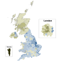
File:United Kingdom EU membership referendum 2016 map.svg
Appearance

Size of this PNG preview of this SVG file: 334 × 599 pixels. Other resolutions: 134 × 240 pixels | 267 × 480 pixels | 428 × 768 pixels | 571 × 1,024 pixels | 1,142 × 2,048 pixels | 512 × 918 pixels.
Original file (SVG file, nominally 512 × 918 pixels, file size: 3.27 MB)
File history
Click on a date/time to view the file as it appeared at that time.
| Date/Time | Thumbnail | Dimensions | User | Comment | |
|---|---|---|---|---|---|
| current | 10:48, 1 September 2024 |  | 512 × 918 (3.27 MB) | MOTORAL1987 | Reverted to version as of 00:47, 15 November 2023 (UTC) the previous map was awful it was pixelated in parts especially on the London section and not fit for purpose so reverting to this version |
| 06:51, 19 July 2024 |  | 1,235 × 1,235 (2.51 MB) | PoliticsMaps | File uploaded using svgtranslate tool (https://svgtranslate.toolforge.org/). Added translation for ckb. | |
| 06:50, 19 July 2024 |  | 1,235 × 1,235 (2.51 MB) | PoliticsMaps | File uploaded using svgtranslate tool (https://svgtranslate.toolforge.org/). Added translation for bho. | |
| 06:48, 19 July 2024 |  | 1,235 × 1,235 (2.51 MB) | PoliticsMaps | File uploaded using svgtranslate tool (https://svgtranslate.toolforge.org/). Added translation for wuu. | |
| 06:48, 19 July 2024 |  | 1,235 × 1,235 (2.51 MB) | PoliticsMaps | File uploaded using svgtranslate tool (https://svgtranslate.toolforge.org/). Added translation for yue. | |
| 06:46, 19 July 2024 |  | 1,235 × 1,235 (2.51 MB) | PoliticsMaps | File uploaded using svgtranslate tool (https://svgtranslate.toolforge.org/). Added translation for pnb. | |
| 06:44, 19 July 2024 |  | 1,235 × 1,235 (2.51 MB) | PoliticsMaps | File uploaded using svgtranslate tool (https://svgtranslate.toolforge.org/). Added translation for lmo. | |
| 06:43, 19 July 2024 |  | 1,235 × 1,235 (2.51 MB) | PoliticsMaps | File uploaded using svgtranslate tool (https://svgtranslate.toolforge.org/). Added translation for eml. | |
| 06:40, 19 July 2024 |  | 1,235 × 1,235 (2.5 MB) | PoliticsMaps | File uploaded using svgtranslate tool (https://svgtranslate.toolforge.org/). Added translation for eo. | |
| 06:39, 19 July 2024 |  | 1,235 × 1,235 (2.5 MB) | PoliticsMaps | File uploaded using svgtranslate tool (https://svgtranslate.toolforge.org/). Added translation for si. |
File usage
The following 2 pages use this file:
Global file usage
The following other wikis use this file:
- Usage on pt.wikipedia.org
- Usage on www.wikidata.org


