
File:Ukraine KIIS-Regional-division.png
Original file (1,181 × 825 pixels, file size: 33 KB, MIME type: image/png)
| This is a file from the Wikimedia Commons. Information from its description page there is shown below. Commons is a freely licensed media file repository. You can help. |

|
This locator map image could be re-created using vector graphics as an SVG file. This has several advantages; see Commons:Media for cleanup for more information. If an SVG form of this image is available, please upload it and afterwards replace this template with
{{vector version available|new image name}}.
It is recommended to name the SVG file “Ukraine KIIS-Regional-division.svg”—then the template Vector version available (or Vva) does not need the new image name parameter. |
Summary
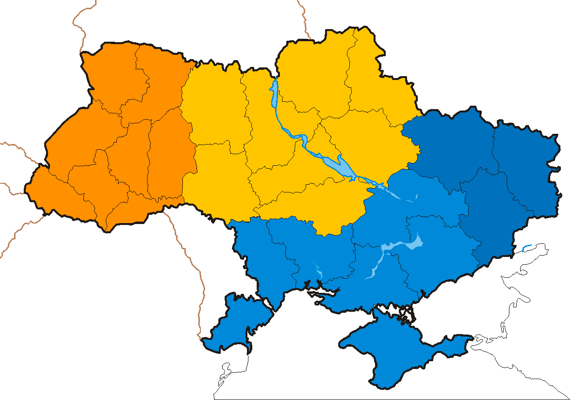
Non-administrative regional division of Ukraine used by KIIS in election polls. The Western region (orange) comprises the eight regions of the west - Volynska, Rivnenska, Lvivska, Ivano-Frankivska, Ternopilska, Khmelnytska, Zakarpatska, and Chernivetska regions; the Central region (yellow) is made up by Zhytomyrska, Vinnytska, Kirovohradska, Cherkaska, Poltavska, Sumska, Chernihivska, Kyivska regions and the city of Kyiv; the Southern region (light blue) consists of Dnipropetrovska, Odeska, Mykolayivska, Khersonska, Zaporizka regions and Crimea; the Eastern region (dark blue) includes Kharkivska, Donetska and Luhanska regions (cf. http://www.kiis.com.ua/eng/doc/09022006/press09022006.doc archive copy at the Wayback Machine)
Licensing
| I, the copyright holder of this work, release this work into the public domain. This applies worldwide. In some countries this may not be legally possible; if so: I grant anyone the right to use this work for any purpose, without any conditions, unless such conditions are required by law. |
File history
Click on a date/time to view the file as it appeared at that time.
| Date/Time | Thumbnail | Dimensions | User | Comment | |
|---|---|---|---|---|---|
| current | 17:17, 19 February 2006 | | 1,181 × 825 (33 KB) | Muumi | Non-administrative Regional divison of Ukraine used by KIIS in election polls. The Western region (orange) comprises the eight regions of the west - Volynska, Rivnenska, Lvivska, Ivano-Frankivska, Ternopilska, Khmelnytska, Zakarpatska, and Chernivetska re |
File usage
The following page uses this file:
Global file usage
The following other wikis use this file:
- Usage on fr.wikipedia.org
- Usage on ko.wikipedia.org
- Usage on nl.wikipedia.org
- Usage on zh.wikipedia.org