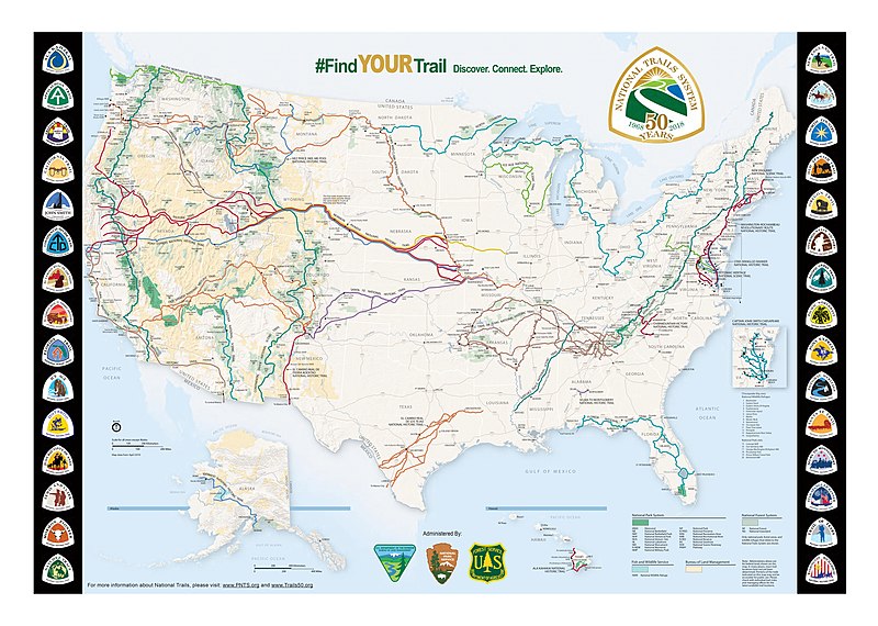
File:US National Trails System, 50th Anniversary map.jpg
Appearance

Size of this preview: 800 × 570 pixels. Other resolutions: 320 × 228 pixels | 640 × 456 pixels | 1,024 × 729 pixels | 1,280 × 912 pixels | 2,560 × 1,823 pixels | 8,130 × 5,791 pixels.
Original file (8,130 × 5,791 pixels, file size: 3.79 MB, MIME type: image/jpeg)
File history
Click on a date/time to view the file as it appeared at that time.
| Date/Time | Thumbnail | Dimensions | User | Comment | |
|---|---|---|---|---|---|
| current | 06:40, 20 July 2020 |  | 8,130 × 5,791 (3.79 MB) | Ungulates | PDF image saved with higher resolution and less compression. |
| 06:37, 20 July 2020 |  | 4,065 × 2,895 (1.38 MB) | Ungulates | {{subst:Upload marker added by en.wp UW}} {{Information |Description = {{en|National Trails System map produced in 2008 to commemorate the 50th anniversary of the National Trails System Act. In addition to the trails, this map shows the unique badges used to guide hikers on each one.}} |Source = https://www.nps.gov/subjects/nationaltrailssystem/maps.htm |Date = 2018 |Author = National Park Service }} |
File usage
The following 8 pages use this file:
- List of long-distance trails in the United States
- National Trails System
- Wikipedia:Articles for deletion/Flagler Trail
- Wikipedia:Articles for deletion/Log/2022 June 6
- Wikipedia:Main Page history/2022 November 25
- Wikipedia:Main Page history/2022 November 25b
- Wikipedia:Today's featured list/November 2022
- Wikipedia:Today's featured list/November 25, 2022
Global file usage
The following other wikis use this file:
- Usage on cs.wikipedia.org
- Usage on www.wikidata.org

