File:USGS-PP1661d-fig22.png
Appearance
USGS-PP1661d-fig22.png (340 × 411 pixels, file size: 500 KB, MIME type: image/png)
File history
Click on a date/time to view the file as it appeared at that time.
| Date/Time | Thumbnail | Dimensions | User | Comment | |
|---|---|---|---|---|---|
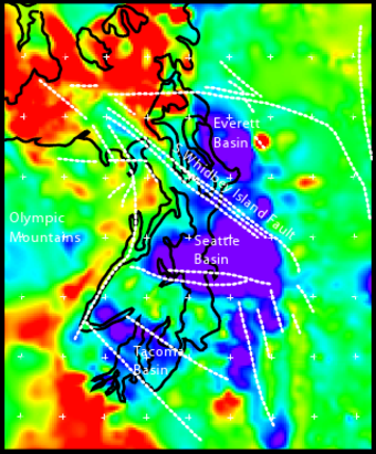
| current | 23:13, 24 April 2010 |  | 340 × 411 (500 KB) | J. Johnson | {{Information |Description={{en|1=Geophysical anomalies and crustal faulting in the Puget Lowland, showing Everett, Tacoma, and Seattle Basins. Bouger gravity anomaly data combined with seismic reflection traveltime data to model rock density at 5 km de |
File usage
The following page uses this file:
Global file usage
The following other wikis use this file:
- Usage on it.wikipedia.org


