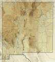
File:USA New Mexico relief location map.svg
Appearance

Size of this PNG preview of this SVG file: 533 × 600 pixels. Other resolutions: 213 × 240 pixels | 426 × 480 pixels | 682 × 768 pixels | 910 × 1,024 pixels | 1,820 × 2,048 pixels | 1,245 × 1,401 pixels.
Original file (SVG file, nominally 1,245 × 1,401 pixels, file size: 2.84 MB)
File history
Click on a date/time to view the file as it appeared at that time.
| Date/Time | Thumbnail | Dimensions | User | Comment | |
|---|---|---|---|---|---|
| current | 15:09, 2 February 2021 |  | 1,245 × 1,401 (2.84 MB) | SANtosito | Uploaded own work with UploadWizard |
File usage
More than 100 pages use this file. The following list shows the first 100 pages that use this file only. A full list is available.
- Abiquiu Lake
- Aggie Memorial Stadium
- Albuquerque, New Mexico
- Angel Fire Resort
- Animas Mountains
- Animas River
- Baldy Mountain (Colfax County, New Mexico)
- Baldy Mountain (Taos County, New Mexico)
- Bandelier National Monument
- Beautiful Mountain
- Big Hatchet Mountains
- Big Hatchet Peak
- Bisti/De-Na-Zin Wilderness
- Black Mountain (Catron County, New Mexico)
- Blue Range Wilderness
- Bonito Lake
- Bosque Peak
- Brantley Lake
- Caballo Lake
- Cantonment Burgwin
- Capitan Mountains
- Capulin Volcano National Monument
- Carlsbad, New Mexico
- Carlsbad Caverns National Park
- Cathey Peak
- Cavern City Air Terminal
- Chicoma Mountain
- Cibola National Forest
- Clovis Regional Airport
- Double Eagle II Airport
- East Potrillo Mountains
- El Vado Lake
- Elephant Butte Reservoir
- Fajada Butte
- Fajada Gap
- Farmington, New Mexico
- Four Corners Regional Airport
- Fruitland Formation
- Gallup Municipal Airport
- Gila Wilderness
- Glenrio, New Mexico and Texas
- Grant County Airport (New Mexico)
- Heron Lake (New Mexico)
- Jemez Mountains
- Jornada del Muerto Volcano
- Kenna, New Mexico
- Kirtland Air Force Base
- Kirtland Formation
- Las Cruces, New Mexico
- Lea County Regional Airport
- Lechuguilla Cave
- Lincoln National Forest
- List of ski areas and resorts in the United States
- Los Alamos County Airport
- Manzano Peak
- McKnight Mountain
- Mescalero Ridge
- Mount Taylor (New Mexico)
- Mount Walter (New Mexico)
- Mud Lake (New Mexico)
- Navajo Lake
- New Mexico Charity Classic
- New Mexico Classic
- Ocate Peak
- Organ Mountains
- Pajarito Mountain Ski Area
- Pecos National Historical Park
- Pecos Wilderness
- Petroglyph National Monument
- Portales, New Mexico
- Quay, New Mexico
- Raton Formation
- Raton Pass
- Red Bluff Reservoir
- Red Lake (Arizona–New Mexico)
- Redondo Peak
- Rio Hondo (Northern New Mexico)
- Rio Rancho, New Mexico
- Roswell International Air Center
- Salinas Peak
- San Mateo Mountains (Cibola County, New Mexico)
- Santa Fe National Forest
- Shiprock
- Sierra Blanca (New Mexico)
- Ski Apache
- Snow Lake (New Mexico)
- South Baldy (New Mexico)
- Taiban, New Mexico
- Taos Regional Airport
- Taos Ski Valley, New Mexico
- Tingley Coliseum
- Tooth of Time
- Tucumcari Mountain
- University Stadium (Albuquerque)
- Urraca Mesa
- Valles Caldera
- Venado Peak
- West Blue Mountain (New Mexico)
- Wheeler Peak (New Mexico)
- White Sands National Park
View more links to this file.
Global file usage
The following other wikis use this file:
- Usage on ca.wikipedia.org
- Usage on de.wikipedia.org
- Sacramento Mountains
- Red Lake (New Mexico)
- Nacimientogebirge
- Mount Taylor (New Mexico)
- Shiprock
- Wheeler Peak (New Mexico)
- City of Rocks State Park
- Vorlage:Positionskarte USA New Mexico
- KOBR-Sendemast
- Clayton Lake State Park (New Mexico)
- Rio Grande Gorge
- Chuska Lake
- Valles-Caldera
- Zuni-Bandera
- KBNM
- KGRT
- Cochiti-Staudamm
- KTNN-AM
- KTNN-FM
- KSFR
- KUNM
- Elephant Butte Reservoir
- Silver Lake (Mescalero Apache Reservation)
- Gallup-Raffinerie
- Valles Caldera National Preserve
- Rio Grande Nature Center State Park
- Usage on es.wikipedia.org
- Bosque nacional Carson
- Cañón del Chaco
- Wikiproyecto:Ilustración/Taller de Cartografía/Realizaciones/América del Norte
- Parque nacional White Sands
- Sierra de Mogollón (Nuevo México)
- Monumento nacional El Morro
- Plantilla:Mapa de localización de Nuevo México
- Río Salado (Nuevo México)
- Sierra de Zuñi
- Pico Wheeler
- Bosque nacional de Santa Fe
- Cataratas de Jémez
- Cataratas de Sitting Bull
- Pico Venado
- Cueva Sandía
- Mina El Chino
- Área salvaje Dome
- Bosque nacional Lincoln
- Río La Plata
- Bosque nacional Gila
- Monumento nacional Misiones Pueblo de Salinas
View more global usage of this file.

