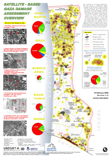
File:UNOSAT GazaStrip Damage Review 19Feb09 v3 Lowres.png
Appearance

Size of this preview: 424 × 600 pixels. Other resolutions: 170 × 240 pixels | 339 × 480 pixels | 543 × 768 pixels | 724 × 1,024 pixels | 2,481 × 3,509 pixels.
Original file (2,481 × 3,509 pixels, file size: 4.54 MB, MIME type: image/png)
File history
Click on a date/time to view the file as it appeared at that time.
| Date/Time | Thumbnail | Dimensions | User | Comment | |
|---|---|---|---|---|---|
| current | 02:10, 8 April 2009 |  | 2,481 × 3,509 (4.54 MB) | Sean.hoyland | {{Information |Description={{en|1=Satellite-Based Gaza Strip Damage Assessment Overview Product ID: 1338 - 10 Mar, 2009 - English This map presents a satellite-based damage assessment for the Gaza Strip following the January ceasefires. Damages have been |
File usage
The following 6 pages use this file:
Global file usage
The following other wikis use this file:
- Usage on ar.wikipedia.org
- Usage on azb.wikipedia.org
- Usage on fa.wikipedia.org
- Usage on he.wikipedia.org
- Usage on pt.wikipedia.org


