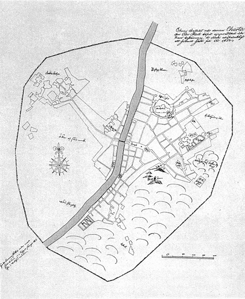
File:Turku map 1634.jpg
Appearance

Size of this preview: 490 × 599 pixels. Other resolutions: 196 × 240 pixels | 392 × 480 pixels | 628 × 768 pixels | 837 × 1,024 pixels | 1,470 × 1,798 pixels.
Original file (1,470 × 1,798 pixels, file size: 177 KB, MIME type: image/jpeg)
File history
Click on a date/time to view the file as it appeared at that time.
| Date/Time | Thumbnail | Dimensions | User | Comment | |
|---|---|---|---|---|---|
| current | 22:13, 26 June 2009 |  | 1,470 × 1,798 (177 KB) | Jontts | {{Information |Description = {{en|Oldest known map of Turku, Finland, 1634.}} {{fi|Vanhin Turun kartta, vuodelta 1634}} |Source = http://scripta.kotus.fi/www/verkkojulkaisut/julk125/turku/turku_kartta_1630.shtml |Date = 1634 |Author = Olof Gangius |Permi |
File usage
The following page uses this file:
Global file usage
The following other wikis use this file:
- Usage on fi.wikipedia.org
- Usage on ru.wikipedia.org
- Usage on uk.wikipedia.org
