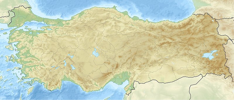
File:Turkey relief location map.jpg
Appearance

Size of this preview: 800 × 343 pixels. Other resolutions: 320 × 137 pixels | 640 × 274 pixels | 1,579 × 677 pixels.
Original file (1,579 × 677 pixels, file size: 749 KB, MIME type: image/jpeg)
File history
Click on a date/time to view the file as it appeared at that time.
| Date/Time | Thumbnail | Dimensions | User | Comment | |
|---|---|---|---|---|---|
| current | 12:42, 28 June 2010 |  | 1,579 × 677 (749 KB) | Uwe Dedering | {{Information |Description={{de|Positionskarte der Türkei}} Quadratische Plattkarte, N-S-Streckung 120 %. Geographische Begrenzung der Karte: * N: 42.5° N * S: 35.5° N * W: 25.4° O * O: 45.0° O {{en|Location map of [[:en:Turkey|Turkey |
File usage
More than 100 pages use this file. The following list shows the first 100 pages that use this file only. A full list is available.
- 1999 Düzce earthquake
- Adana
- Ankara
- Antalya
- Aphrodisias
- Archaeological Museum of Manisa
- Atatürk Dam
- Aydın
- Ayvaini Cave
- Bakırçay
- Balıkesir
- Basilica Cistern
- Batman Dam
- Battle of Chaldiran
- Battle of Corupedium
- Battle of Harran
- Battle of Ipsus
- Battle of Issus
- Battle of Lade
- Battle of Magnesia
- Battle of Mount Scorobas
- Battle of Myonessus
- Battle of Shirimni
- Battle of Svindax
- Battle of the Eurymedon (190 BC)
- Battle of the Granicus
- Birecik Dam
- Bosporus
- Bursa
- Cilician Gates
- Colossae
- Dardanelles
- Demaratus
- Denizli
- Devegeçidi Dam
- Dicle Dam
- Didyma
- Diyarbakır
- Dorylaeum
- Ephesus
- Eskişehir
- Ethnography Museum of Ankara
- Gaziantep
- Germiyanids
- Gulf of İzmir
- Göbekli Tepe
- Göreme Historical National Park
- Hacilar
- Hadrian's Gate
- Halicarnassus
- Hattusa
- Ilısu Dam
- Imbros
- Istanbul
- Kahramanmaraş
- Karakaya Dam
- Karkamış Dam
- Keban Dam
- Konya
- Kralkızı Dam
- Labraunda
- Lagina
- Lake Eğirdir
- Lake Tuz
- Lake Uluabat
- Lake Van
- List of national parks of Turkey
- Magnesia on the Maeander
- Malatya
- Manisa
- Mausoleum at Halicarnassus
- Mersin
- Miletus
- Mor Hananyo Monastery
- Mount Ararat
- Mount Hasan
- Mount Ida (Turkey)
- Mount Nemrut
- Mount Sipylus
- Muğla
- Mycale
- NATO Integrated Air Defense System
- Nevalı Çori
- Nur Mountains
- Pamukkale
- Phoenix of Tenedos
- Salih Ada
- Samʾal
- Sardis
- Sea of Marmara
- Siege of Amida (359)
- Tekirdağ
- Trabzon
- Troy
- Turkish Air Force
- Tushhan
- Tyana
- Uzungöl
- Van, Turkey
- Yamanlar
View more links to this file.
Global file usage
The following other wikis use this file:
- Usage on als.wikipedia.org
- Usage on am.wikipedia.org
- Usage on ar.wikipedia.org
- معركة أنقرة
- قالب:خريطة مواقع تركيا
- فالق شمال الأناضول
- مستخدم:عبد المؤمن/مسودات/خرائط/تركيا
- مستخدم:"Yahia"/ملعب
- نهر مراد
- وحدة:Location map/data/Turkey
- وحدة:Location map/data/Turkey/شرح
- نفق الاستقلال 15 يوليو
- أطلس جت الرحلة 4203
- أولودنيز
- زلزال معمورة العزيز 2020
- قونور ألب
- الاشتباكات الحدودية التركية السورية خلال الحرب الأهلية السورية
- زلزال قهرمان مرعش 2023
- زلزال أرزنجان 1939
- زلزال أضنة وجيحان 1998
- زلزال أميك 1872
- Usage on arz.wikipedia.org
- Usage on ast.wikipedia.org
- Usage on av.wikipedia.org
- Usage on azb.wikipedia.org
- Usage on az.wikipedia.org
View more global usage of this file.


