
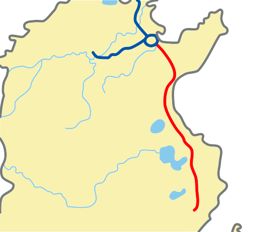
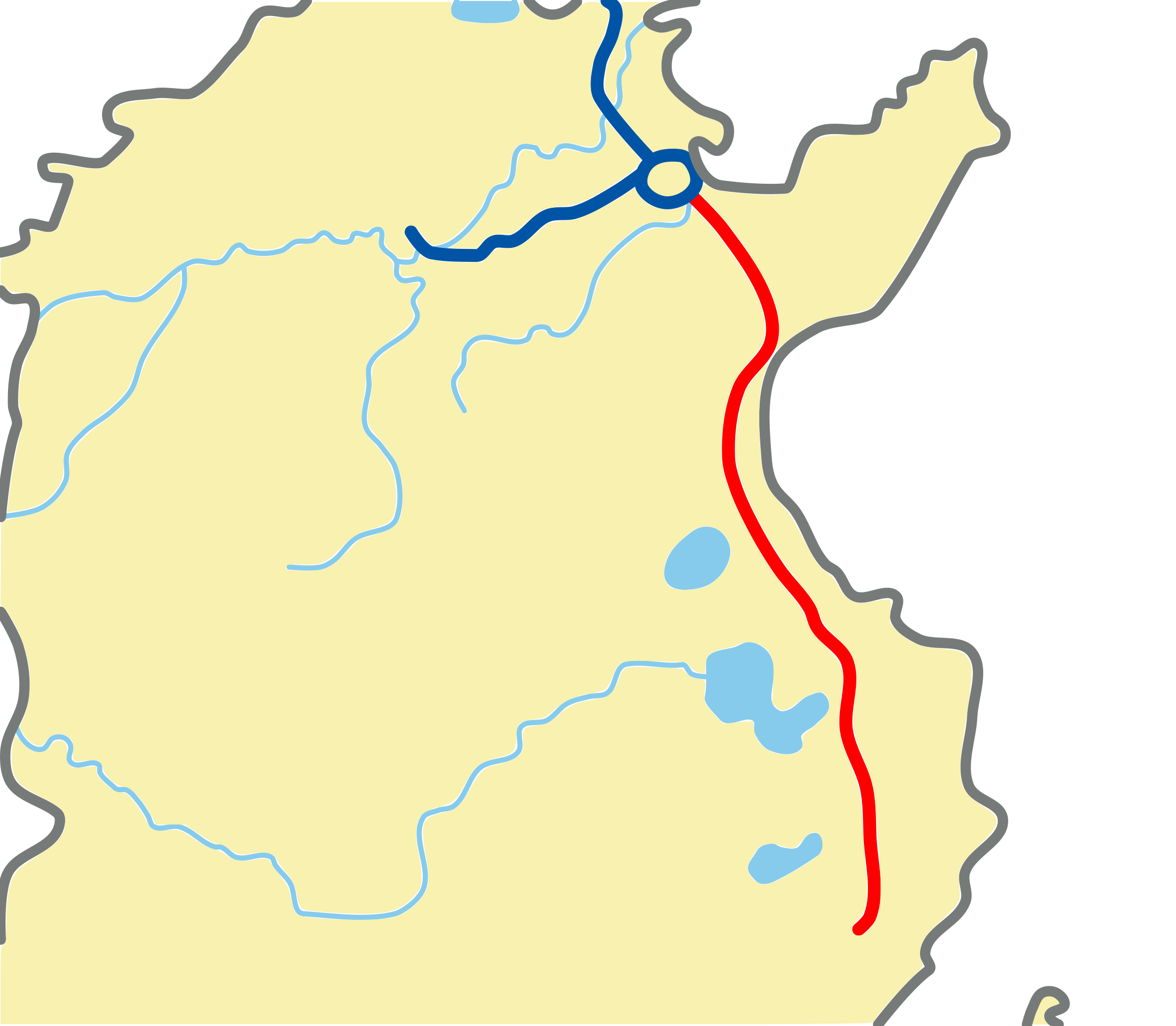
File:Tunisia a1 map.svg

Size of this PNG preview of this SVG file: 227 × 198 pixels. Other resolutions: 275 × 240 pixels | 550 × 480 pixels | 881 × 768 pixels | 1,174 × 1,024 pixels | 2,348 × 2,048 pixels.
Original file (SVG file, nominally 227 × 198 pixels, file size: 47 KB)
| This is a file from the Wikimedia Commons. Information from its description page there is shown below. Commons is a freely licensed media file repository. You can help. |
Summary
| Description |
English: Autoroute A1 map, Tunisia.
Français : Carte de l'autoroute A1 Tunisie. |
| Source | Own work |
| Author | MHz`as |
Licensing
| I, the copyright holder of this work, release this work into the public domain. This applies worldwide. In some countries this may not be legally possible; if so: I grant anyone the right to use this work for any purpose, without any conditions, unless such conditions are required by law. |
File history
Click on a date/time to view the file as it appeared at that time.
| Date/Time | Thumbnail | Dimensions | User | Comment | |
|---|---|---|---|---|---|
| current | 04:26, 20 September 2010 | | 227 × 198 (47 KB) | MHz`as | {{Information |Description={{en|1=Autoroute A1 map, Tunisia.}} {{fr|1=Carte de l'autoroute A1 Tunisie.}} |Source={{own}} |Author=MHz`as |Date= |Permission= |other_versions= }} Category:Tunis-Ras Jedir motorway [[Category:Maps of Tunis |
File usage
The following page uses this file:
Global file usage
The following other wikis use this file:
- Usage on hu.wikipedia.org
- Usage on nl.wikipedia.org
- Usage on www.wikidata.org
- Usage on zh.wikipedia.org