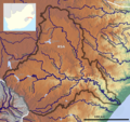
File:Tugela Basin OSM.png
Appearance

Size of this preview: 638 × 600 pixels. Other resolutions: 255 × 240 pixels | 511 × 480 pixels | 817 × 768 pixels | 1,089 × 1,024 pixels | 1,752 × 1,647 pixels.
Original file (1,752 × 1,647 pixels, file size: 5.22 MB, MIME type: image/png)
File history
Click on a date/time to view the file as it appeared at that time.
| Date/Time | Thumbnail | Dimensions | User | Comment | |
|---|---|---|---|---|---|
| current | 07:49, 12 October 2021 |  | 1,752 × 1,647 (5.22 MB) | Peter in s | Contrast |
| 15:21, 11 July 2020 |  | 1,752 × 1,647 (4.79 MB) | Peter in s | little things | |
| 11:24, 11 July 2020 |  | 1,752 × 1,647 (4.8 MB) | Peter in s | {{Information |description ={{en|1=The Tugela River Basin (OSM)}} |date =2020-07-11 |source =https://maps-for-free.com |author =Hans Braxmeier & Peter in s }} {{cc-by-sa-2.0}} Category:Maps of rivers of South Africa Category:Drainage basin maps of Africa Category:Tugela River |
File usage
The following 2 pages use this file:
Global file usage
The following other wikis use this file:
- Usage on de.wikipedia.org
- Usage on fr.wikipedia.org
- Usage on hr.wikipedia.org
- Usage on pt.wikipedia.org
