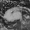
File:Tropical Storm Dorothy (1970).jpg
Appearance

Size of this preview: 600 × 600 pixels. Other resolutions: 240 × 240 pixels | 480 × 480 pixels | 768 × 768 pixels | 1,024 × 1,024 pixels | 2,241 × 2,241 pixels.
Original file (2,241 × 2,241 pixels, file size: 2.04 MB, MIME type: image/jpeg)
File history
Click on a date/time to view the file as it appeared at that time.
| Date/Time | Thumbnail | Dimensions | User | Comment | |
|---|---|---|---|---|---|
| current | 19:56, 4 May 2024 |  | 2,241 × 2,241 (2.04 MB) | Sandy14156 | cropped |
| 21:38, 9 November 2008 |  | 3,002 × 2,437 (979 KB) | Hurricanehink | {{Information |Description={{en|1=Satellite image of Tropical Storm Dorothy east of the Lesser Antilles}} |Source=http://www.nhc.noaa.gov/archive/storm_wallets/cdmp/dvd0032-jpg/1970/atlantic/dorothy/satpic/s191357z.jpg |Author=ATS-3 Satellite |Date=1970-0 |
File usage
The following 3 pages use this file:
Global file usage
The following other wikis use this file:
- Usage on es.wikipedia.org
- Usage on pt.wikipedia.org

