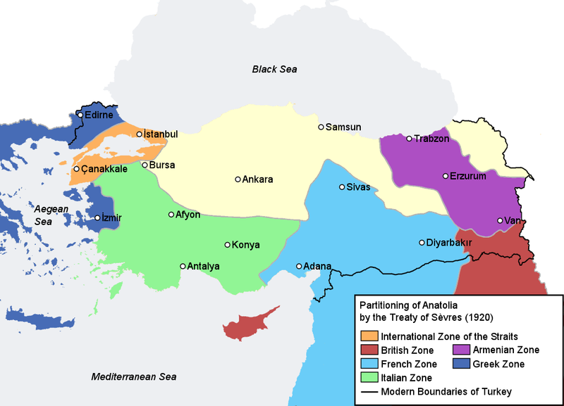
File:TreatyOfSevres.png
Appearance

Size of this preview: 800 × 577 pixels. Other resolutions: 320 × 231 pixels | 640 × 461 pixels | 1,024 × 738 pixels.
Original file (1,024 × 738 pixels, file size: 124 KB, MIME type: image/png)
File history
Click on a date/time to view the file as it appeared at that time.
| Date/Time | Thumbnail | Dimensions | User | Comment | |
|---|---|---|---|---|---|
| current | 13:11, 15 August 2007 |  | 1,024 × 738 (124 KB) | AtilimGunesBaydin | Some visual improvements. |
| 18:24, 10 August 2007 |  | 1,024 × 738 (125 KB) | AtilimGunesBaydin | {{Information |Description=Map illustrating the partitioning of Anatolia according to the Treaty of Sèvres (1920) after World War I. |Source=Self-made, information compiled from [http://www.let.uu.nl/~martin.van |
File usage
The following 3 pages use this file:
Global file usage
The following other wikis use this file:
- Usage on cs.wikipedia.org
- Usage on de.wikipedia.org
- Usage on he.wikipedia.org
- Usage on hy.wikipedia.org
- Usage on ka.wikipedia.org
- Usage on ku.wikipedia.org

