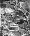
File:TorontoThorncliffeAerial1942.jpg
Appearance

Size of this preview: 498 × 600 pixels. Other resolutions: 199 × 240 pixels | 398 × 480 pixels | 638 × 768 pixels | 850 × 1,024 pixels | 1,700 × 2,048 pixels | 6,223 × 7,495 pixels.
Original file (6,223 × 7,495 pixels, file size: 4.82 MB, MIME type: image/jpeg)
File history
Click on a date/time to view the file as it appeared at that time.
| Date/Time | Thumbnail | Dimensions | User | Comment | |
|---|---|---|---|---|---|
| current | 22:45, 24 July 2011 |  | 6,223 × 7,495 (4.82 MB) | JosephIWMolto | {{Information |Description ={{en|1=Aerial Photograph of Throncliffe, York Township (Toronto), 1942}} |Source =http://www.toronto.ca/archives/maps/s97_f11.htm |Author =Metropolitan Toronto Planning Department |Date =1942-04-03 |
File usage
The following 2 pages use this file:

