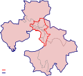
File:Thessaloniki urban and metropolitan areas map.svg
Appearance

Size of this PNG preview of this SVG file: 800 × 593 pixels. Other resolutions: 320 × 237 pixels | 640 × 474 pixels | 1,024 × 759 pixels | 1,280 × 949 pixels | 2,560 × 1,898 pixels.
Original file (SVG file, nominally 1,024 × 759 pixels, file size: 189 KB)
File history
Click on a date/time to view the file as it appeared at that time.
| Date/Time | Thumbnail | Dimensions | User | Comment | |
|---|---|---|---|---|---|
| current | 12:32, 11 February 2019 |  | 1,024 × 759 (189 KB) | Sarah fides | Minor corrections |
| 12:31, 11 February 2019 |  | 1,024 × 759 (189 KB) | Sarah fides | Gulfs and lakes | |
| 11:26, 11 February 2019 |  | 1,024 × 759 (186 KB) | Sarah fides | Updated map | |
| 18:58, 24 August 2011 |  | 550 × 504 (301 KB) | Sarah fides | minor fix | |
| 17:33, 24 August 2011 |  | 550 × 504 (299 KB) | Sarah fides | fixed. | |
| 17:30, 24 August 2011 |  | 592 × 504 (118 KB) | Sarah fides | Different font | |
| 17:19, 24 August 2011 |  | 550 × 504 (114 KB) | Sarah fides | {{Information |Description={{en|1=The urban and metropolitan areas of Thessaloniki, Greece since 2011.}} |Source=*File:Greece_2011_Periferiakes_Enotites.svg |Date=2011-08-24 17:19 (UTC) |Author=*File:Greece_2011_Periferiakes_Enotites.svg: [[Us |
File usage
The following 4 pages use this file:
Global file usage
The following other wikis use this file:
- Usage on ba.wikipedia.org
- Usage on ceb.wikipedia.org
- Usage on el.wikipedia.org
- Usage on fr.wikipedia.org
- Usage on hu.wikipedia.org
- Usage on it.wikivoyage.org
- Usage on ja.wikipedia.org
- Usage on ka.wikipedia.org
- Usage on ko.wikipedia.org
- Usage on ru.wikipedia.org
- Usage on sv.wikipedia.org
- Usage on tr.wikipedia.org
- Usage on tt.wikipedia.org
- Usage on www.wikidata.org

